You can also view GPS and digital compass infor- mation as you shoot. The benefit is that this allows you to zero in on a
To view device settings, first make sure GPS device is set to [Enable], then select GPS device set- tings/GPS information display.
![]() ENABLING THE DIGITAL COMPASS
ENABLING THE DIGITAL COMPASS
To enable the digital compass, make sure [GPS device] in your camera’s
![]() GEOTAGGING IMAGES AS YOU SHOOT
GEOTAGGING IMAGES AS YOU SHOOT
Set the
![]() LOGGING YOUR ROUTE
LOGGING YOUR ROUTE
Set the
Location logs are recorded daily, at set intervals of your choice, and stored in the receiver. The
interval settings are available on your camera’s GPS device settings menu:
First, make sure GPS device is set to Enable, then select GPS device settings/Position update timing, then select the interval you want. Intervals range from once per second to every 5 minutes. Shorter intervals provide more precise tracking but reduce battery life. Longer intervals do the reverse.
Generally speaking, the longer your route and the larger the area you will be covering, the greater your positioning intervals can be. Conversely, you may prefer shorter intervals if you need to track a circuitous route within a small area. Keep in mind, however, that the tracking accuracy cannot exceed that of the
![]() SETTING GPS SYNCHRONIZED TIME
SETTING GPS SYNCHRONIZED TIME
By default, the date and time recorded in your im- age’s EXIF data files will be derived from the date and time settings in your camera. For more accurate and precise time notations (within
1.Enable the GPS and select GPS device settings.
2.Select [Auto time setting]
3.Select the time setting you prefer:
[Set now] will set the time based on the GPS signal and let the camera maintain the time from then on.
[Auto update] will automatically update the time whenever the camera and
![]() PRECAUTIONS
PRECAUTIONS
Some countries or regions may place restrictions on the use of GPS devices. When in doubt, ask before using the
Keep in mind that others may be able to locate you or others based on the coordinates in your geotagged images. Be careful before posting photo- graphs of your home, office, private residences, or other personally identifiable information.
Never leave the
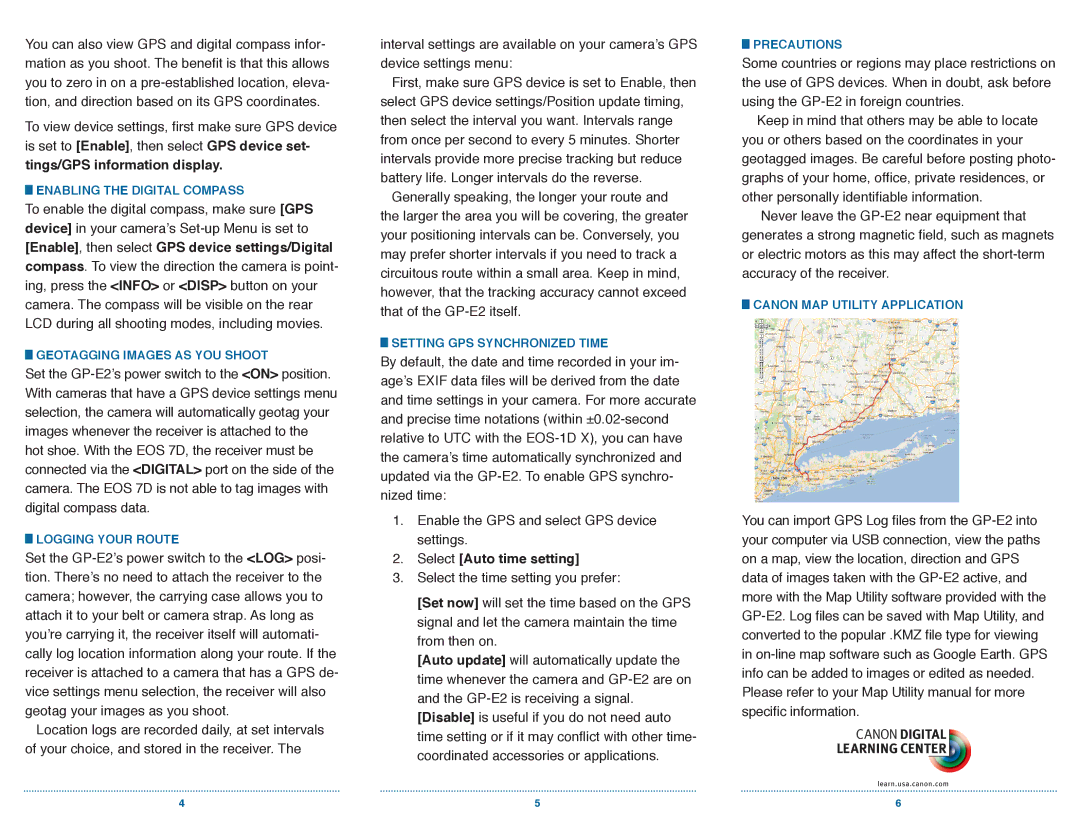
![]() CANON MAP UTILITY APPLICATION
CANON MAP UTILITY APPLICATION
You can import GPS Log files from the
4 | 5 | 6 |