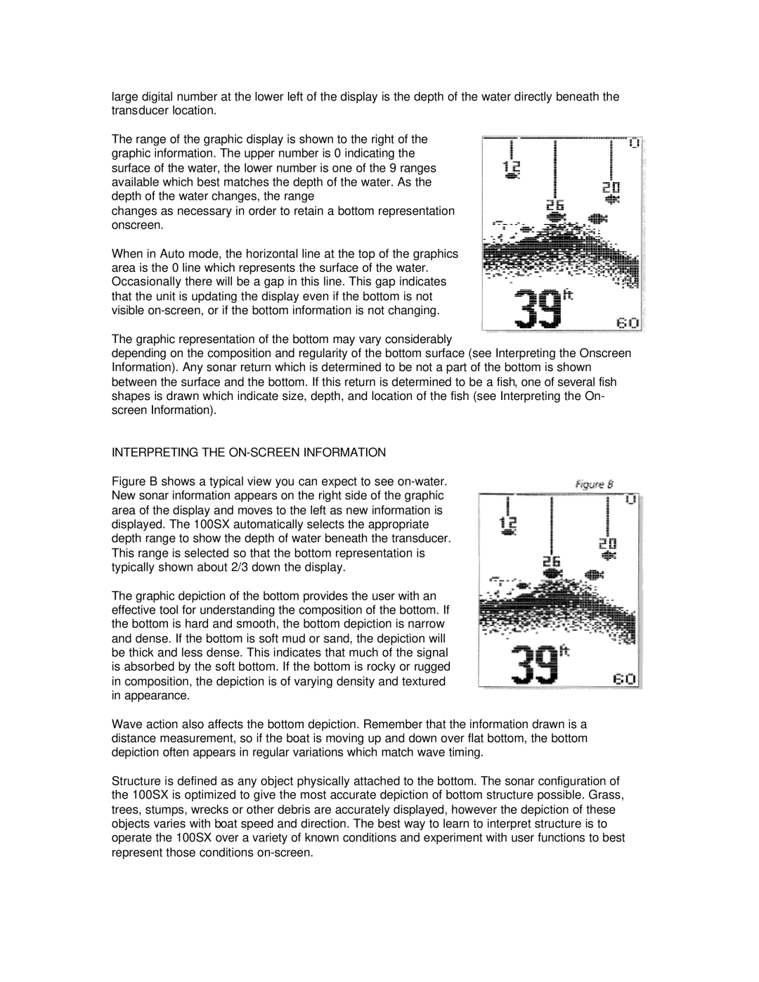
large digital number at the lower left of the display is the depth of the water directly beneath the transducer location.

The range of the graphic display is shown to the right of the graphic information. The upper number is 0 indicating the surface of the water, the lower number is one of the 9 ranges available which best matches the depth of the water. As the depth of the water changes, the range

changes as necessary in order to retain a bottom representation onscreen.

When in Auto mode, the horizontal line at the top of the graphics area is the 0 line which represents the surface of the water. Occasionally there will be a gap in this line. This gap indicates that the unit is updating the display even if the bottom is not visible on-screen, or if the bottom information is not changing.

The graphic representation of the bottom may vary considerably

depending on the composition and regularity of the bottom surface (see Interpreting the Onscreen Information). Any sonar return which is determined to be not a part of the bottom is shown between the surface and the bottom. If this return is determined to be a fish, one of several fish shapes is drawn which indicate size, depth, and location of the fish (see Interpreting the On- screen Information).

INTERPRETING THE ON-SCREEN INFORMATION

Figure B shows a typical view you can expect to see on-water. New sonar information appears on the right side of the graphic area of the display and moves to the left as new information is displayed. The 100SX automatically selects the appropriate depth range to show the depth of water beneath the transducer. This range is selected so that the bottom representation is typically shown about 2/3 down the display.

The graphic depiction of the bottom provides the user with an effective tool for understanding the composition of the bottom. If the bottom is hard and smooth, the bottom depiction is narrow and dense. If the bottom is soft mud or sand, the depiction will be thick and less dense. This indicates that much of the signal is absorbed by the soft bottom. If the bottom is rocky or rugged in composition, the depiction is of varying density and textured in appearance.

Wave action also affects the bottom depiction. Remember that the information drawn is a distance measurement, so if the boat is moving up and down over flat bottom, the bottom depiction often appears in regular variations which match wave timing.

Structure is defined as any object physically attached to the bottom. The sonar configuration of the 100SX is optimized to give the most accurate depiction of bottom structure possible. Grass, trees, stumps, wrecks or other debris are accurately displayed, however the depiction of these objects varies with boat speed and direction. The best way to learn to interpret structure is to operate the 100SX over a variety of known conditions and experiment with user functions to best represent those conditions on-screen.

Page 22
Image 22
Humminbird 100SX manual Interpreting the ON-SCREEN Information

100SX specifications

The Humminbird 100SX is a versatile and user-friendly fish finder designed for anglers seeking an efficient and reliable tool for locating fish and navigating waterways. This compact device combines advanced technology with an intuitive interface, making it an ideal choice for both novice and experienced fishermen.

One of the standout features of the Humminbird 100SX is its wide-spectrum sonar technology. Utilizing dual-beam sonar, the 100SX provides exceptional detail and clarity in underwater imaging, allowing users to detect fish and structure beneath the surface with ease. The device can operate at multiple frequencies, ensuring optimal performance in various fishing environments. This dual-beam capability enables a wider coverage area, enhancing the chances of locating schools of fish.

The 100SX comes equipped with a 4-inch grayscale display that boasts a high-resolution screen, providing crisp visuals and clear readings even in diverse lighting conditions. This easy-to-read display helps anglers monitor underwater activity and water depth, making it easier to track fish movements and identify potential hotspots.

Additionally, this fish finder includes a built-in fish alarm feature, alerting users when fish are detected within the designated depth range. This handy function allows for a more efficient fishing experience, keeping anglers focused on their catch. The 100SX also features a deep-water capability of up to 600 feet, providing ample range for both shallow and deep-water fishing expeditions.

Navigational aids are also a highlight of the Humminbird 100SX. The device is equipped with a precise and responsive GPS system, allowing users to mark waypoints and create custom routes. This feature is invaluable for returning to fishing spots or navigating unfamiliar waters, enhancing the overall fishing experience.

In terms of design, the Humminbird 100SX is built for durability and ease of use. Its robust construction ensures it can withstand the rigors of outdoor conditions while remaining lightweight and portable. Installation is straightforward, making it accessible for users of all skill levels.

Overall, the Humminbird 100SX is a reliable and effective fish finder that combines innovative sonar technology with practical features. Its ease of use, detailed imaging, and navigational capabilities make it a valuable tool for anglers looking to maximize their fishing success on the water. Whether you are a weekend warrior or a seasoned pro, the Humminbird 100SX is an excellent addition to any fishing setup.