383c specifications
The Humminbird 383c is a powerful fish finder that combines advanced sonar technology with ease of use, making it an essential tool for anglers looking to enhance their fishing experience. This model features a large, vibrant 3.5-inch color display, offering crystal-clear images and easy navigation through menus and settings.One of the main features of the 383c is its DualBeam PLUS sonar system, which provides exceptional coverage and detail. This technology allows you to select between two beam widths, giving you the flexibility to focus on a specific area or cover a more extensive zone. The 200 kHz beam offers a narrow, detailed view, making it easier to identify fish and structures, while the 83 kHz beam provides a wider coverage area, ensuring you don’t miss any potential hotspots.
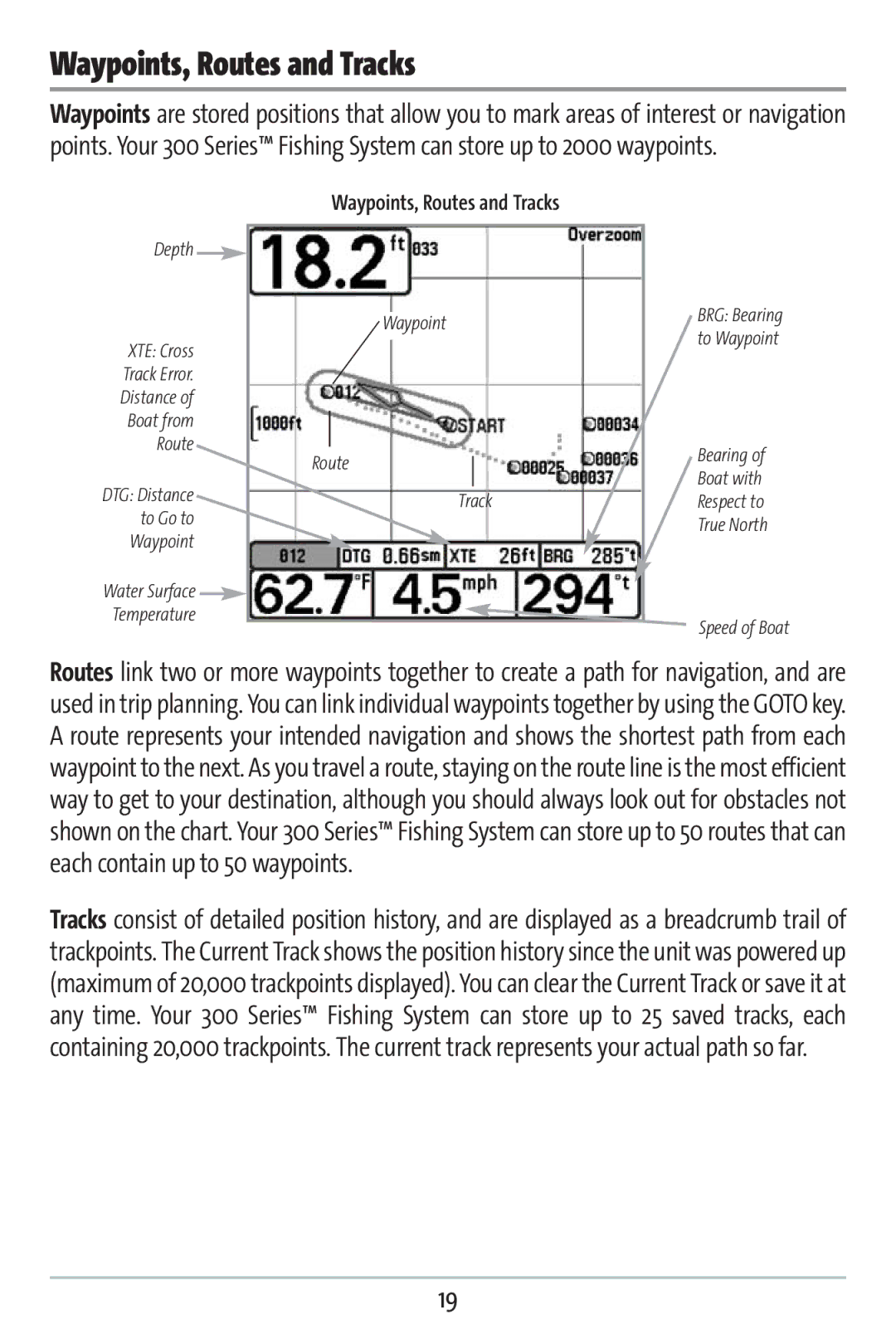
The 383c also boasts a built-in GPS chartplotter, which is ideal for mapping out your favorite fishing spots and navigating with precision. This feature can store up to 2,500 waypoints, allowing you to mark locations of interest, such as fishing holes, underwater structures, or hazards. The unit is compatible with Humminbird's proprietary mapping software, including LakeMaster and Navionics, providing access to detailed charts for numerous water bodies.
Another highlight of the Humminbird 383c is its Fish ID+ technology, which simplifies the process of identifying fish species. This system utilizes sonar returns to provide visual icons representing different types of fish, allowing anglers to quickly assess what’s below. The built-in temperature gauge is yet another valuable feature, providing real-time water temperature readings, which can help in determining the best fishing strategies based on fish behavior.
The unit’s user-friendly interface ensures that even novice anglers can operate it with ease. The menu system is intuitive, allowing users to access essential functions quickly. With its durable construction and waterproof design, the Humminbird 383c can withstand the rigors of fishing environments, making it a reliable companion on the water.
Overall, the Humminbird 383c blends advanced technology with practical features to deliver an exceptional fishing tool. Whether you are a seasoned angler or just starting, this fish finder is designed to enhance your fishing trips by providing accurate information and increasing your chance of a successful catch.

