C-Series specifications
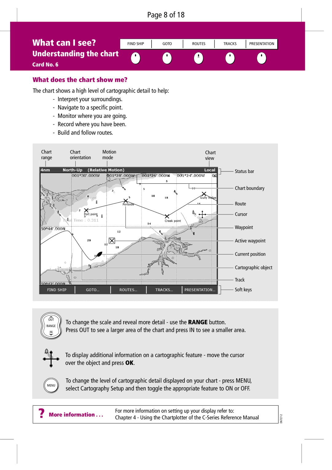
The Raymarine C-Series is a sophisticated line of multifunction displays (MFDs) designed for marine navigation and boating enthusiasts. Offering a blend of advanced technologies and user-friendly interfaces, these devices are tailored to meet diverse maritime needs.One of the standout features of the Raymarine C-Series is its crystal-clear display. With a variety of screen sizes available, ranging from 5 to 12 inches, all models boast bright, high-resolution color screens that ensure excellent visibility in various lighting conditions, even under direct sunlight. The displays are equipped with Raymarine's exclusive LightHouse software, which provides intuitive navigation through a streamlined interface, allowing users to easily access charts, radar, sonar, and other essential applications.
The C-Series integrates seamlessly with various navigation tools, including GPS, AIS, and chart plotting capabilities. This integration ensures that users can navigate with precision and confidence. The built-in GPS receiver features fast acquisition times, allowing for accurate positioning even in challenging environments. The C-Series supports a wide array of vector and raster charts, providing users with comprehensive navigational data from trusted sources.
Another impressive aspect of the Raymarine C-Series is its sonar capabilities. The devices support advanced sonar technologies, including CHIRP sonar and DownVision. This allows users to achieve high-resolution underwater imagery and detailed fish-finding capabilities, making it an excellent choice for sport fishing enthusiasts. The C-Series can also connect to various transducers, enabling users to customize their sonar options based on their specific needs.
For those looking to enhance their boating experience further, the C-Series offers integration with a range of optional accessories. Functionality can be expanded with the addition of radar, autopilot systems, thermal imaging cameras, and more. The multifunction display can act as the central hub for all onboard systems, facilitating easy monitoring and control.
Wireless connectivity is another noteworthy feature of the C-Series. Users can connect their smartphones and tablets through Wi-Fi, allowing for easy access to navigation apps and sharing of data with crew members. The Raymarine App enables remote viewing and control of the display, enhancing operational flexibility.
In conclusion, the Raymarine C-Series is an excellent choice for mariners seeking a reliable and feature-rich navigation system. With its high-quality displays, advanced sonar technology, and seamless integration capabilities, it stands out as a top-tier option in the marine electronics market, catering to both recreational and professional users alike.

