GPSMAP496

GPSMAP496

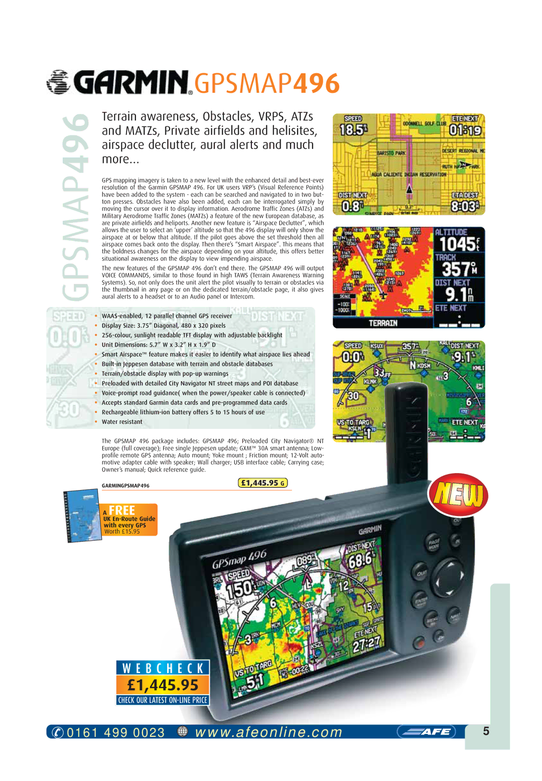
Terrain awareness, Obstacles, VRPS, ATZs and MATZs, Private airfields and helisites, airspace declutter, aural alerts and much more…

GPS mapping imagery is taken to a new level with the enhanced detail and best-ever resolution of the Garmin GPSMAP 496. For UK users VRP’s (Visual Reference Points) have been added to the system - each can be searched and navigated to in two but- ton presses. Obstacles have also been added, each can be interrogated simply by moving the cursor over it to display information. Aerodrome Traffic Zones (ATZs) and Military Aerodrome Traffic Zones (MATZs) a feature of the new European database, as are private airfields and heliports. Another new feature is “Airspace Declutter”, which allows the user to select an ‘upper’ altitude so that the 496 display will only show the airspace at or below that altitude. If the pilot goes above the set threshold then all airspace comes back onto the display. Then there’s “Smart Airspace”. This means that the boldness changes for the airspace depending on your altitude, this offers better situational awareness on the display to view impending airspace.

The new features of the GPSMAP 496 don’t end there. The GPSMAP 496 will output VOICE COMMANDS, similar to those found in high TAWS (Terrain Awareness Warning Systems). So, not only does the unit alert the pilot visually to terrain or obstacles via the thumbnail in any page or on the dedicated terrain/obstacle page, it also gives aural alerts to a headset or to an Audio panel or Intercom.

WAAS-enabled, 12 parallel channel GPS receiver

Display Size: 3.75” Diagonal, 480 x 320 pixels

256-colour, sunlight readable TFT display with adjustable backlight

Unit Dimensions: 5.7” W x 3.2” H x 1.9” D

Smart Airspace™ feature makes it easier to identify what airspace lies ahead

Built-in Jeppesen database with terrain and obstacle databases

Terrain/obstacle display with pop-up warnings

Preloaded with detailed City Navigator NT street maps and POI database

Voice-prompt road guidance( when the power/speaker cable is connected)

Accepts standard Garmin data cards and pre-programmed data cards

Rechargeable lithium-ion battery offers 5 to 15 hours of use

Water resistant

The GPSMAP 496 package includes: GPSMAP 496; Preloaded City Navigator® NT Europe (full coverage); Free single Jeppesen update; GXM™ 30A smart antenna; Low- profile remote GPS antenna; Auto mount; Yoke mount ; Friction mount; 12-Volt auto- motive adapter cable with speaker; Wall charger; USB interface cable; Carrying case; Owner’s manual; Quick reference guide.

GARMINGPSMAP496

£1,445.95 G

AFREE

UK En-Route Guide

with every GPS

Worth £15.95

W E B CH E C K

£1,445.95

CHECK OUR LATEST ON-LINE PRICE

0161 499 0023

www.afeonline.com

5

Page 2
Image 2
Visual Land GPSMAP 296 owner manual GPSMAP496, £1,445.95 G