NX-700A specifications
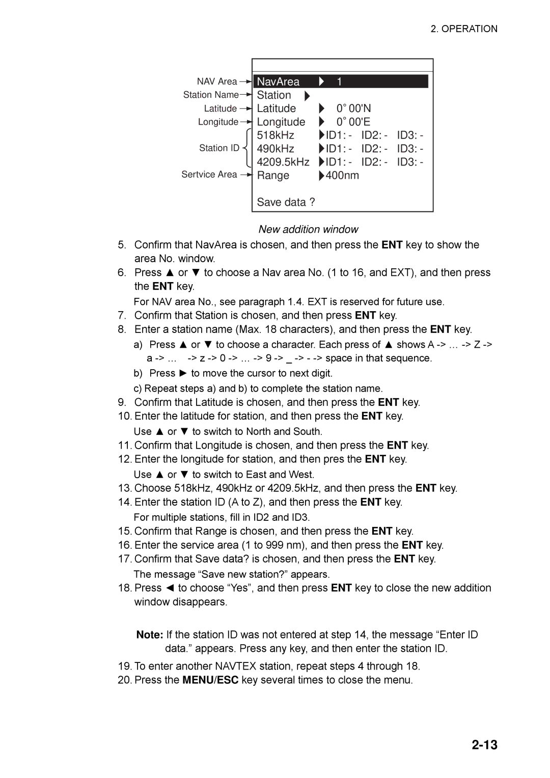
The Furuno NX-700A is an advanced navigation system designed specifically for professional mariners and commercial vessels. Known for its robust performance and precision, it integrates state-of-the-art technology to enhance safety and efficiency at sea. One of the most notable features of the NX-700A is its dual-channel frequency system, which allows for improved target detection and tracking capabilities. This dual-channel operation ensures that the system can differentiate between multiple targets, reducing the risk of collisions and enhancing situational awareness.Another significant aspect of the NX-700A is its high-resolution display. The system is equipped with a large LCD screen that provides clear and detailed graphical representations of surrounding waters, including navigational aids and potential hazards. The intuitive interface allows for easy operation even in challenging conditions, ensuring that crews can concentrate on their primary task: safe navigation.
Further enhancing the usability of the NX-700A is its advanced GPS functionality. The system employs multi-GNSS (Global Navigation Satellite System) technology, enabling it to obtain accurate position fixes from various satellite constellations, including GPS, GLONASS, and BeiDou. This capability ensures that mariners receive reliable positioning data regardless of their location, which is crucial during navigation in remote areas.
The NX-700A also features robust connectivity options, including NMEA 2000 and NMEA 0183 support. This allows the system to interface seamlessly with other onboard equipment, such as autopilots, engine monitoring systems, and electronic chart plotters. Such integration enhances operational efficiency and aids in maintaining a central command point for navigation.
Marine safety is further bolstered with the NX-700A's built-in man-overboard function, which provides rapid and precise positioning information in emergency situations. The system can also store critical navigational data, which can be accessed quickly during emergencies, contributing to enhanced safety protocols on board.
In summary, the Furuno NX-700A is a sophisticated navigation solution that combines high-resolution displays, advanced GPS technology, dual-channel frequency systems, and robust connectivity. Whether used in fishing vessels, cargo ships, or pleasure yachts, the NX-700A stands out as a reliable tool for enhancing maritime safety and navigation efficiency. With its user-friendly interface and essential features, it embodies the modern requirements of marine navigation technology.

