5.2FIS-B TFRs
Temporary Flight Restrictions (TFRs) provide detailed information for local
short term restrictions. The update rate is approximately every 20 minutes.
NOTE: Some TFRs may not be shown or information may be incomplete.The presented TFR information is only advisory in nature. Check official sources, such as from preflight planning or Flight Service Station to determine more complete TFR information.
5.3FIS-B METARs
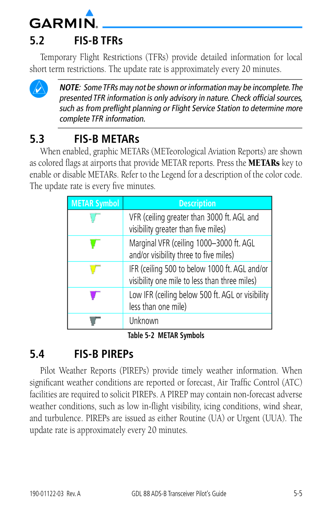
When enabled, graphic METARs (METeorological Aviation Reports) are shown as colored flags at airports that provide METAR reports. Press the METARs key to enable or disable METARs. Refer to the Legend for a description of the color code. The update rate is every five minutes.
METAR Symbol
Description
VFR (ceiling greater than 3000 ft. AGL and visibility greater than five miles)
Marginal VFR (ceiling
IFR (ceiling 500 to below 1000 ft. AGL and/or visibility one mile to less than three miles)
Low IFR (ceiling below 500 ft. AGL or visibility less than one mile)
Unknown
Table
5.4FIS-B PIREPs
Pilot Weather Reports (PIREPs) provide timely weather information. When
significant weather conditions are reported or forecast, Air Traffic Control (ATC)
facilities are required to solicit PIREPs. A PIREP may contain
weather conditions, such as low
and turbulence. PIREPs are issued as either Routine (UA) or Urgent (UUA). The
update rate is approximately every 20 minutes.
GDL 88 |