Capturing
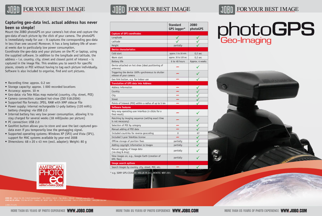
Mount the JOBO photoGPS on your camera’s
Coordinate the
•Recording time: approx. 0.2 sec
•Storage capacity: approx. 1 000 recorded locations
•Accuracy: approx. 10 m
•
•Camera connection: standard
•Supported file formats: JPEG, RAW with XMP sidecar file
•Power supply: internal rechargeable
battery charging: via USB 2.0
•Internal battery has very low power consumption, allowing it to stay charged for several weeks (18 millijoules per picture)
•PC connection: USB 2.0
•GeoHint button allows you to store and save the last captured geo- data even if you temporarily lose the geotagging signal.
•Supported operating systems: Windows XP (SP2) and Vista (SP1), support for MAC systems available by
•Dimensions: 68 x 20 x 43 mm (excl. adapter); Weight: 80 g
| Standard | JOBO |
| GPS logger* | photoGPS |
|
|
|
Capture of GPS coordinates |
|
|
Longitude |
|
|
Latitude |
|
|
Height | partially |
|
Device characteristics |
|
|
Cold start | approx. 5 to 30 min | 0,2 sec |
Warm start | approx. 30 to 120 sec | 0,2 sec |
Battery life | 6 to 48 hours | Approx. 4 weeks |
|
|
|
Device attached on hot shoe (ideal positioning of |
|
|
antenna) |
|
|
Triggering the device 100% synchronous to shutter |
|
|
release of your camera |
|
|
Geo hint button, e.g. for indoor use |
|
|
|
|
|
Translation of GPS data into Address |
|
|
Address information |
|
|
Country |
|
|
|
|
|
City |
|
|
Street |
|
|
|
|
|
Points of Interest (POI) within a radius of up to 5 km |
|
|
Software features |
|
|
Very easy operating user interface (4 clicks for a |
|
|
final result) |
|
|
Matching by imaging sequence (setting exact time |
|
|
is not necessary) |
|
|
|
|
|
Selection of POI by category |
|
|
Manual adding of POI data |
|
|
Included countries for reverse geocoding | 0 | 67 |
Included |
|
|
Offline storage of position fixes | partially |
|
|
|
|
Adding copyright information to images | partially |
|
Manual tagging of image data | partially |
|
(via drag & drop) |
| |
|
| |
View images on, e.g., Google Earth (creation of | partially |
|
KML files) |
| |
|
| |
|
|
|
Image search options |
|
|
Search images by country, city, street, POI, etc. |
|
|
* e.g. SONY |
| |
JOBO AG · Kölner Str. 58 · 51645 Gummersbach · Tel.: 02261 /
JOBO AG US office · P.O. Box 87310 · Canton, MI 48187 USA · Ph: +1 (734)
�������������������������������������� ![]()
![]()
![]()
![]()
![]()
![]() ��������������������������������������
�������������������������������������� ![]()
![]()
![]()
![]()
![]()
![]() ��������������������������������������
��������������������������������������
