NorthStar Navigation 438 Palette, Color bar, Digit size, Bottom lock, Fish symbols, Data header

Models: 435 438

1 32
Download 32 pages 24.89 Kb
Page 12
Image 12

Palette

Use this to select a color palette. Each color within the palette represents a different echo strength, as shown on the sonar displays.

There is a choice of five color palettes: Black, Blue, White, Vivid and 8 color. The first four display more detail, whilst the 8 color palette shows a greater distinction of signal strength between each adjacent color. For the 16 color palette, each color covers 1.5 dB signal range. For the 8 color palette, each color covers 3 dB signal range.

Color bar

This shows the range of colors used for the selected color palette.

It can be switched On or Off. If switched On, it is displayed down the left hand side of all the sonar displays.

Digit size

Use this to change the size of the depth display on the sonar displays. There is a choice of: Small, Medium and Large.

Bottom lock

If Bottom lock is On, the zoom section moves so the bottom is always displayed in the zoom section, regardless of changes in depth.

If Bottom lock is Off, the bottom will not be displayed in the zoom section when it is outside the range covered by the zoom bar.

Using the Bottom Lock and the A-Scope features together can be a powerful aid in recognising the type of bottom.

Fish symbols

These appear only in the main sonar displays. Fish symbols can be shown in three ways:

3-3 Setup > Fuel (Explorer 438 only)

As a fish symbol (On).

As a fish symbol with the depth

(On+depth). The depth is shown beside the fish symbol.

Switched off (Off) so that echoes are not converted to fish symbols but are displayed directly.

See section 4-2 Fish detection and display, for more information about fish symbols.

Interference filter

This filters the echo signal to reduce high-level, spiky interference, such as engine noise.

It can be switched On or Off.

Data header

The data header can be turned On or Off.

When On, it is a customizable feature that can be used to display up to 6 data items, such as boat speed or fuel used.

To customize the size of the Data header, highlight Size and press . There is a choice of Small and Large.

To customize the data items to be displayed:

1.Highlight Data setup and press. The Data header increases in size to display all 6 data fields. Some data fields may be blank.

2.Use or to move from data field to data field.

3.Press at any data field to show the list of data items that can be displayed there.

4.Highlight the required data item and press

. The data item is immediately displayed in that data field.

5.Press or MENU when finished and the Data header resizes automatically.

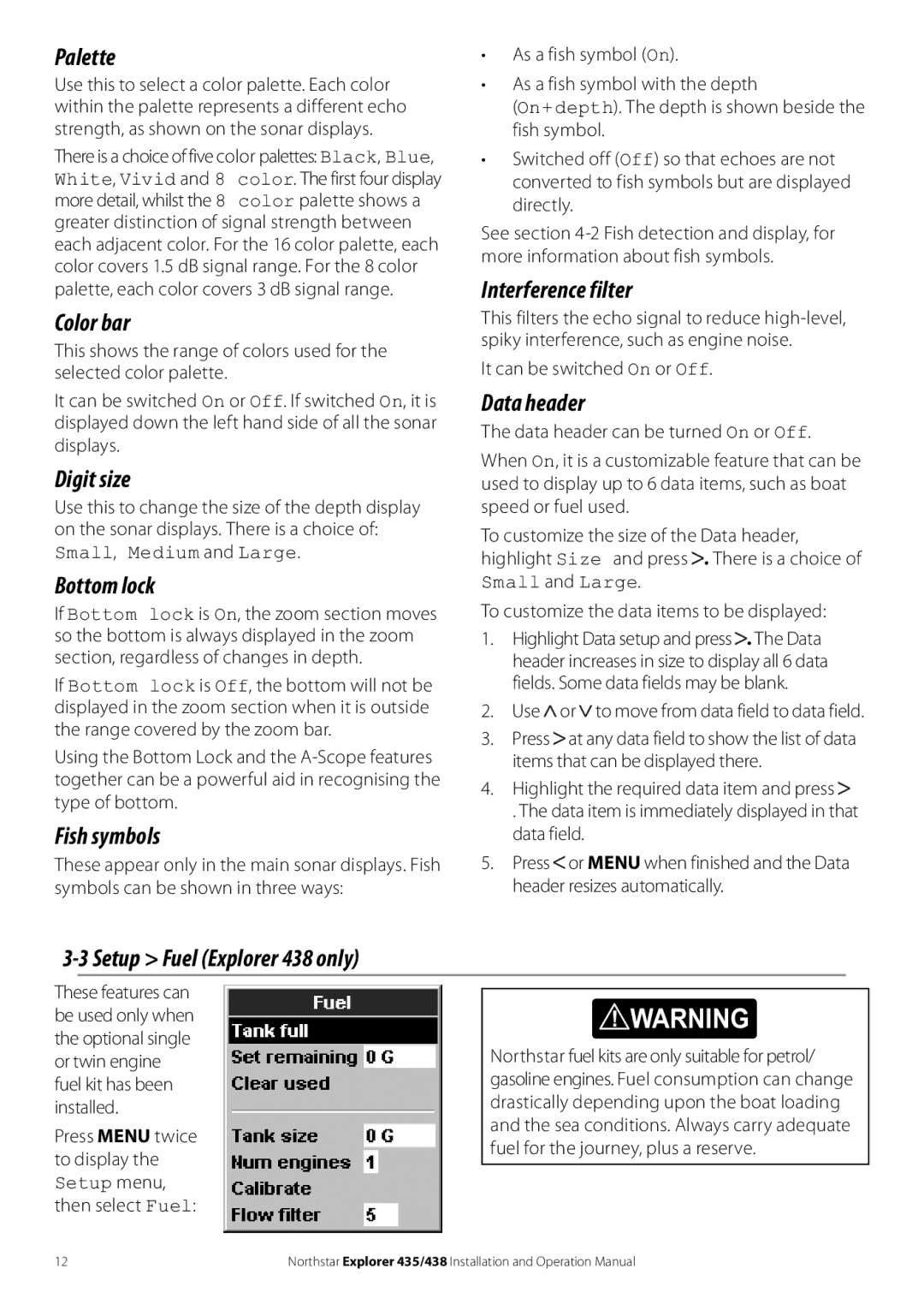
These features can be used only when the optional single or twin engine fuel kit has been installed.

Press MENU twice to display the Setup menu, then select Fuel:

! WARNING

Northstar fuel kits are only suitable for petrol/ gasoline engines. Fuel consumption can change drastically depending upon the boat loading and the sea conditions. Always carry adequate fuel for the journey, plus a reserve.

12

Northstar Explorer 435/438 Installation and Operation Manual

Page 12
Image 12
NorthStar Navigation 435 Palette, Color bar, Digit size, Bottom lock, Fish symbols, Setup Fuel Explorer 438 only

435, 438 specifications

NorthStar Navigation 438,435 is a cutting-edge navigation solution designed to enhance maritime and aerial operations with advanced technology and user-friendly features. This state-of-the-art equipment focuses on delivering precision, reliability, and efficiency, making it an essential tool for professionals in various fields including marine transportation, aviation, and logistics.

One of the main features of the NorthStar Navigation 438,435 is its high-accuracy positioning capability. Utilizing multiple GNSS (Global Navigation Satellite System) signals, including GPS, GLONASS, Galileo, and BeiDou, the system can provide a positioning accuracy of up to 10 centimeters in real-time. This ensures that users can navigate confidently in challenging environments, whether at sea or in the air.

The navigation device also boasts robust integration capabilities with other onboard systems. It supports various communication protocols, allowing seamless interfacing with radar, AIS (Automatic Identification System), and autopilot systems. This integrated approach facilitates comprehensive situational awareness, enabling operators to make informed decisions swiftly.

Moreover, the NorthStar Navigation 438,435 features an intuitive user interface designed for ease of use. The touchscreen display provides clear visuals and customizable layouts, allowing users to tailor the information presented to their specific needs. With multiple language support and user-friendly controls, the system caters to diverse operators across different geographic regions.

Another defining characteristic of the NorthStar Navigation 438,435 is its resilience in harsh conditions. Built to withstand severe weather, it meets stringent marine and aviation industry standards for durability and reliability. The system is both waterproof and shock-resistant, ensuring optimal performance even in extreme environments.

In addition to its hardware capabilities, the NorthStar Navigation 438,435 incorporates advanced software features such as real-time route planning and environmental monitoring. Users can analyze weather patterns and potential hazards along their route, optimizing travel time and enhancing safety.

Overall, the NorthStar Navigation 438,435 stands as a reliable, feature-rich navigation solution that harmonizes advanced technology with user-centric design. Its focus on accuracy, integration, ease of use, and durability makes it an indispensable tool for navigating the complexities of modern transportation, ensuring successful missions across diverse maritime and aerial operations.