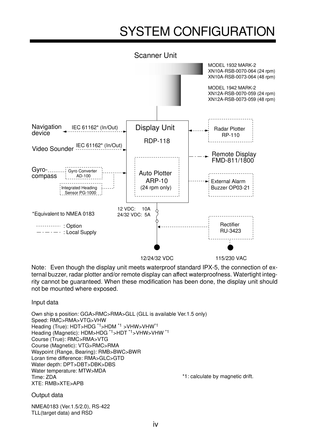
1932 MARK-2 specifications
The Furuno 1932 MARK-2 is a state-of-the-art radar system designed for maritime applications, providing exceptional performance and reliability. This advanced radar unit is renowned for its impressive range, superior target detection capabilities, and user-friendly interface, making it an essential tool for vessels of all sizes.One of the standout features of the Furuno 1932 MARK-2 is its high-resolution display. The 10.4-inch color LCD screen offers crystal-clear visuals, enabling mariners to easily interpret radar data. With the capability to display 16 different colors, users can customize their views for enhanced clarity, allowing for better discrimination between targets and clutter. Additionally, the unit incorporates adjustable gain and clutter control, giving operators the ability to fine-tune the radar image to suit varying conditions, whether in busy harbors or open waters.
The 1932 MARK-2 utilizes a powerful 2.2 kW magnetron, allowing for excellent range performance. It can effectively detect targets up to 36 nautical miles away, providing mariners with ample warning of potential hazards. This long-range capability is complemented by advanced target tracking technologies, including ARPA (Automatic Radar Plotting Aid). This system enables users to monitor and track multiple vessels simultaneously, providing essential information such as course, speed, and distance for better situational awareness.
In terms of technology, the Furuno 1932 MARK-2 includes a Fast Target Update feature. This allows for rapid refresh rates, ensuring that moving targets are accurately displayed, even in heavy traffic areas. The unit also employs advanced digital signal processing to filter out noise and improve target detection, enhancing overall operational efficiency.
Another key characteristic of the 1932 MARK-2 is its robust build quality. Designed to withstand the marine environment, the unit features a waterproof casing with an IP55 rating, ensuring durability against splashes and humidity. Furthermore, its compact design offers versatile mounting options, making it adaptable for various vessel configurations.
Overall, the Furuno 1932 MARK-2 radar system stands out for its blend of advanced technology, user-centric features, and rugged reliability. Its ability to provide clear and accurate radar imagery makes it an invaluable asset for navigators, enhancing safety and efficiency on the water. As an investment in maritime technology, it offers significant advantages to enhance both recreational and commercial navigation.

