FA-100 specifications
The Furuno FA-100 is a sophisticated maritime communication and navigation technology designed to enhance safety and situational awareness for vessels operating in both commercial and recreational capacities. The device is particularly popular among the fishing, cargo, and passenger transport industries, where precise navigation and reliable communication are paramount.One of the standout features of the FA-100 is its AIS (Automatic Identification System) capabilities. This technology enables vessels to automatically send and receive information about their position, course, and speed, significantly improving situational awareness by allowing ships to detect and track nearby vessels. With its dual-channel AIS receiver, the FA-100 can monitor a wide range of traffic in busy shipping lanes, making it easier for operators to avoid potential collisions and navigate safely.
The FA-100 boasts robust GPS functionality, providing accurate position data that is critical for navigation. This positioning system is enhanced by the use of advanced satellite technology, ensuring reliable location tracking even in challenging environments such as dense urban areas or adverse weather conditions. With its high update rate, navigators receive timely information, allowing for informed decision-making.
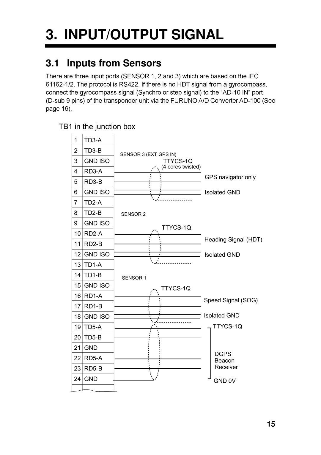
Additionally, the Furuno FA-100 includes various interface options, facilitating the integration with other onboard systems. The device can connect seamlessly with radar, chart plotters, and other navigation equipment, creating a cohesive and comprehensive navigational network. This interoperability enhances overall situational awareness and simplifies vessel operation by providing a unified interface for monitoring and controlling different systems.
Durability is another essential aspect of the FA-100, as it is built to withstand harsh marine environments. Its weatherproof design ensures reliable performance even under extreme conditions, while the user-friendly interface allows operators to access and interpret data quickly and efficiently. The intuitive display is designed to provide clear and concise information, making it suitable for users of varying experience levels.
Overall, the Furuno FA-100 is a highly effective tool for marine navigation and communication. With its advanced AIS capabilities, reliable GPS, extensive interfacing options, and rugged design, it stands out as an essential device for enhancing the safety and efficiency of maritime operations.

