Sensors (compass/altimeter/barometer) are operated
The direction, altitude, and atmospheric pressure can be measured and recorded in the recorded images.
•Information measured on this unit is only a rough indication. Do not use it for technical purposes.
•When using this unit for
Press [MENU/SET].
Press 3/4/2/1 to select [GPS/Sensor] menu, and then press [MENU/SET].
Press 3/4 to select [Sensor Settings], and then press [MENU/
SET].
Press 3/4 to select [ON], and then press [MENU/SET].
A
• | Exit the menu after it is set. | B |
|
|
|
|
| ||||||
|
|
|
|
| ||
• | To switch the environment information |
|
|
|
|
|
| screen, press [DISP.] several times. |
|
|
|
|
|
|
|
|
|
|
| C |
|
|
|
|
|
|
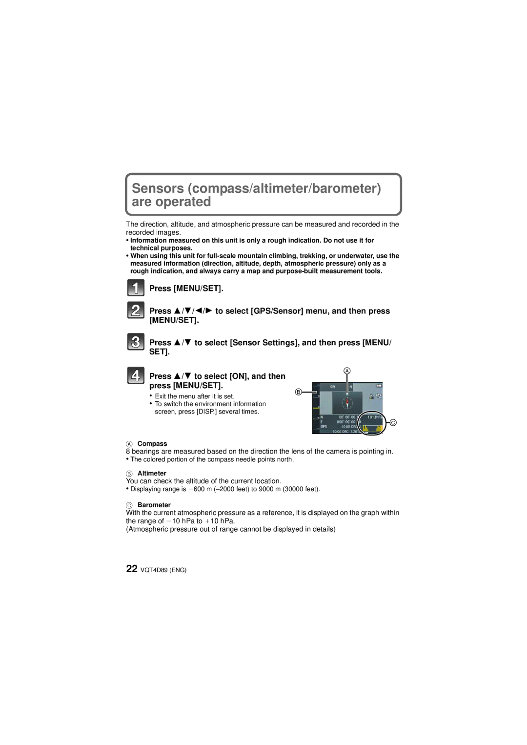
ACompass
8 bearings are measured based on the direction the lens of the camera is pointing in.
•The colored portion of the compass needle points north.
BAltimeter
You can check the altitude of the current location.
•Displaying range is j600 m
CBarometer
With the current atmospheric pressure as a reference, it is displayed on the graph within the range of j10 hPa to _10 hPa.
(Atmospheric pressure out of range cannot be displayed in details)
22 VQT4D89 (ENG)