E N G L I S H
Altitude Trend Scale
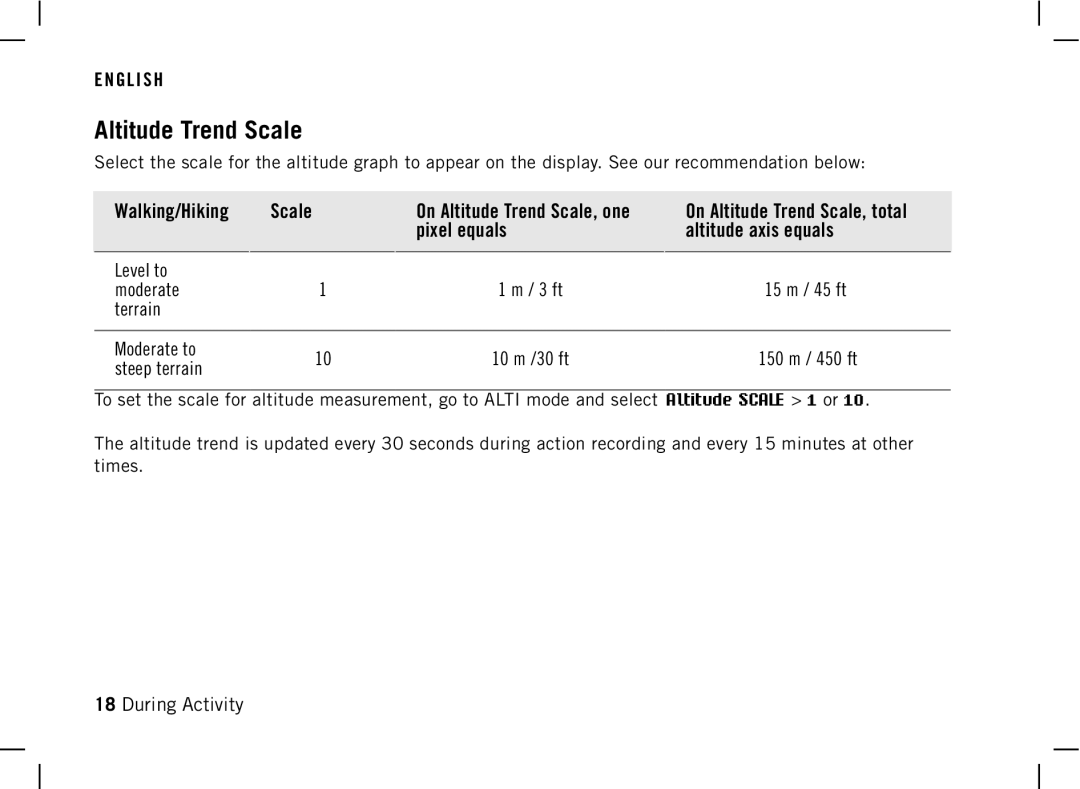
Select the scale for the altitude graph to appear on the display. See our recommendation below:
Walking/Hiking
Scale
On Altitude Trend Scale, one pixel equals
On Altitude Trend Scale, total altitude axis equals
Level to |
|
|
| |
moderate | 1 | 1 m / 3 ft | 15 m / 45 ft | |
terrain |
|
|
| |
|
|
|
| |
Moderate to | 10 | 10 m /30 ft | 150 m / 450 ft | |
steep terrain | ||||
|
|
|
To set the scale for altitude measurement, go to ALTI mode and select Altitude SCALE > 1 or 10.
The altitude trend is updated every 30 seconds during action recording and every 15 minutes at other times.
18 During Activity
