GPS Chartplotter Operations Manual
Thank You
Table of Contents
Iii
Key Functions
Sonar Menu Tab
Chart Menu Tab
Specifications Glossary Contact Humminbird 103
How Sonar Works
Peak to Peak measures power output at the highest points
How GPS and Cartography Work
Single Beam Sonar
Page
Bait Ball Hard Bottom Rocky Bottom
What’s On the Display
Adjacent to your boat, including the following items
Structure where fish may be hiding
Views
Zoom View Chart View Big Digits View
Sonar views
Sonar View
Sonar View
Real Time Sonar RTS Window
Understanding Sonar History
Bottom Presentation
Freeze Frame
Page
Sonar Zoom View
Sonar Zoom View
Circular Flasher View
Big Digits View
Bird’s Eye View
Bird’s Eye View
Chart View without Active Cursor
Chart View
View Orientation
Combo View
Viewing Cartography
Chart View with Cursor Present
Waypoints, Routes and Tracks
Introduction to Navigation
Save, Edit, or Delete a Waypoint
Navigate to a Waypoint or Position
Add a Waypoint Target or Trolling Grid
Navigation X-PressTMmenu
Save, Edit or Delete a Route
Edit, Delete or Hide Saved Tracks
Save or Clear a Current Track
Key Functions
POWER/LIGHT Key
View Key
Info Key
WAY Cursor Control Key
Menu Key
Goto Key
Mark Key
Zoom +/- Key
Exit Key
Menu System
Powering Up the Unit
Sonar Tab Normal Mode Advanced Mode
Start-Up Options Menu
Normal Operation
Normal Simulator System Status
System Status
Simulator
Self Test
Accessory Test
GPS Diagnostic View
GPS Diagnostic View
Sonar views only
Sonar X-PressTMMenu
To adjust the Sensitivity
Sensitivity
Highlight Sensitivity on the Sonar X-PressTMmenu
Upper Range
To adjust the Upper Range
To adjust the Lower Range
Lower Range
Highlight Lower Range on the Sonar X-PressTMmenu
To adjust the Chart Speed
Chart Speed
To adjust the Bottom View
Bottom View
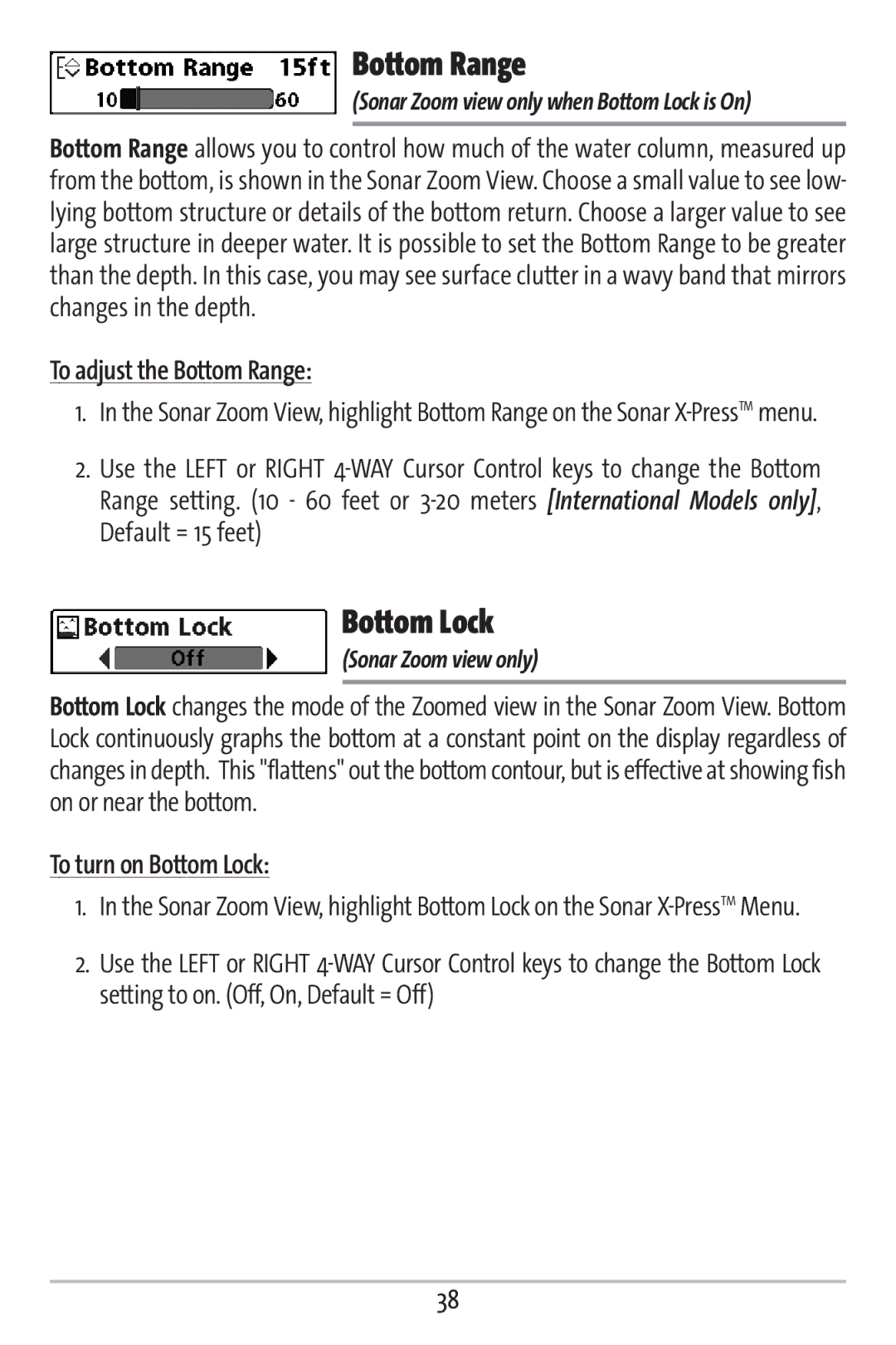
Bottom Range
To adjust the Bottom Range
Bottom Lock
To turn on Bottom Lock
To Cancel Navigation
Cancel Navigation
Highlight Cancel Navigation on the Sonar X-PressTMmenu
Only when Navigating
Navigation views only
Navigation X-PressTMMenu
To view the Waypoint Name Submenu
Waypoint Name
Highlight WaypointName on the Navigation X-PressTMmenu
Waypoint Submenu contains the following menu choices
Cursor to Waypoint
Chart or Combo view only
Save Current Track
To move cursor to a saved waypoint
Clear Current Track
Save Current Route
Skip Next Waypoint
Remove Target
Highlight Cancel Navigation on the Navigation X-PressTMmenu
To Remove a Target
Only if a Target is Active
Sonar Window
Remove Grid
To Remove a Grid
To Set the Size of the Sonar Window in the Combo View
Most recently-created waypoint
Press the Menu key twice to access the Main Menu
Sonar Menu Tab
Sonar tab
To turn Fish ID+ on or off
Fish ID+TM
To change the RTS Window setting
To change the Fish ID Sensitivity setting
Fish ID Sensitivity
Highlight Fish ID Sensitivity on the Sonar main menu
To change the Depth Lines setting
To change the Zoom Width Setting
Zoom Width
Depth Lines
Surface Clutter
To change the Surface Clutter setting
To change the Max Depth setting
To change the Noise Filter setting
Noise Filter
Max Depth
Water Type
To change the Water Type setting
Navigation tab
Navigation Menu Tab
Current Track allows you to view the Current Track submenu
Current Track
To view the Current Track Submenu
Highlight Current Track on the Navigation main menu
Saved Tracks allows you to view the Saved Tracks submenu
Saved Tracks
To view the Saved Tracks Submenu
Highlight Saved Tracks on the Navigation main menu
To view the Waypoints Submenu
Waypoints
Highlight Waypoints on the Navigation main menu
Waypoints Submenu contains the following menu choices
To view the Routes Submenu
Routes
Highlight Routes on the Navigation main menu
Routes Submenu contains the following menu choices
Chart Orientation
North Reference
Grid Rotation
To change the Track Minimum Distance setting
To change the Trackpoint Interval setting
Trackpoint Interval
Track Min Distance
Map Datum
Course Projection Line
Delete All Nav Data
Chart Menu Tab
Chart Detail Level
To change the Chart Detail Level setting
Highlight Chart Detail Level on the Chart main menu
To change the Lat/Lon Grid setting
To change the Map Borders setting
Map Borders
Lat/Lon Grid
To set the Simulation Position
Set Simulation Position
Set Map Offset
To change the Map Offset setting
Clear Map Offset
To Clear Map Offset
Alarms Menu Tab
Fish ID Alarm
Depth Alarm
To change the Depth Alarm setting
To change the Fish ID Alarm setting
Temp Alarm
Low Battery Alarm
To change the Low Battery Alarm setting
To change the Temp Alarm setting
Arrival Alarm
Off Course Alarm
To change the Off Course Alarm setting
To change the Arrival Alarm setting
Alarm Tone
Drift Alarm
To change the Drift Alarm setting
To change the Alarm Tone setting
Setup Menu Tab
Units Depth
Units Temp
Units Distance
User Mode
Units Speed
Language
Restore Defaults
Triplog Reset
To Reset Triplog
To Restore Defaults
Advanced, Sonar view only
Select Readouts
To change the Depth Offset setting
Depth Offset
To Select Readouts
To change the Speed Calibration setting
To change the Temp Offset setting
Temp Offset
Speed Calibration
Local Time Zone
To change the Daylight Saving Time setting
Daylight Saving Time
To change the Local Time Zone
Position Format
To change the Position Format setting
Time Format
To change the Time Format
Date Format
Nmea Output
To change the Date Format
Sonar
To turn Nmea Output on or off
To turn Sonar on or off
Combo View
Views Menu Tab
To Change the View Status of Any View
Highlight the View main menu tab
SeriesTM Defaults to Simulator with a Transducer Attached
Troubleshooting
Display Problems
Problem Possible Cause
Or faulty
Isolation
Finding the Cause of Noise
Boat’s engine
Cavitation from
Specifications
Sonar Terms
Glossary
Page
Page
Page
Page
Receiver See Transmitter