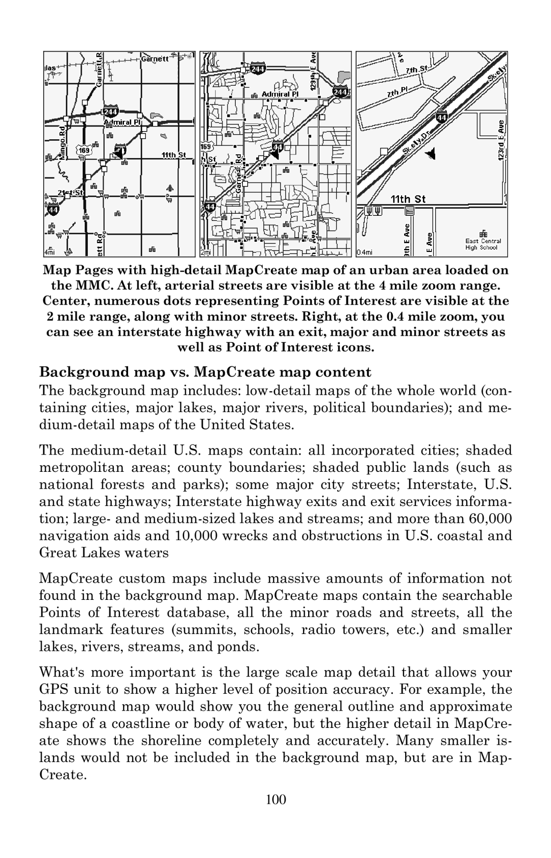
Map Pages with
Center, numerous dots representing Points of Interest are visible at the 2 mile range, along with minor streets. Right, at the 0.4 mile zoom, you can see an interstate highway with an exit, major and minor streets as well as Point of Interest icons.
Background map vs. MapCreate map content
The background map includes:
The
MapCreate custom maps include massive amounts of information not found in the background map. MapCreate maps contain the searchable Points of Interest database, all the minor roads and streets, all the landmark features (summits, schools, radio towers, etc.) and smaller lakes, rivers, streams, and ponds.
What's more important is the large scale map detail that allows your GPS unit to show a higher level of position accuracy. For example, the background map would show you the general outline and approximate shape of a coastline or body of water, but the higher detail in MapCre- ate shows the shoreline completely and accurately. Many smaller is- lands would not be included in the background map, but are in Map- Create.
100