Grades
Introduction
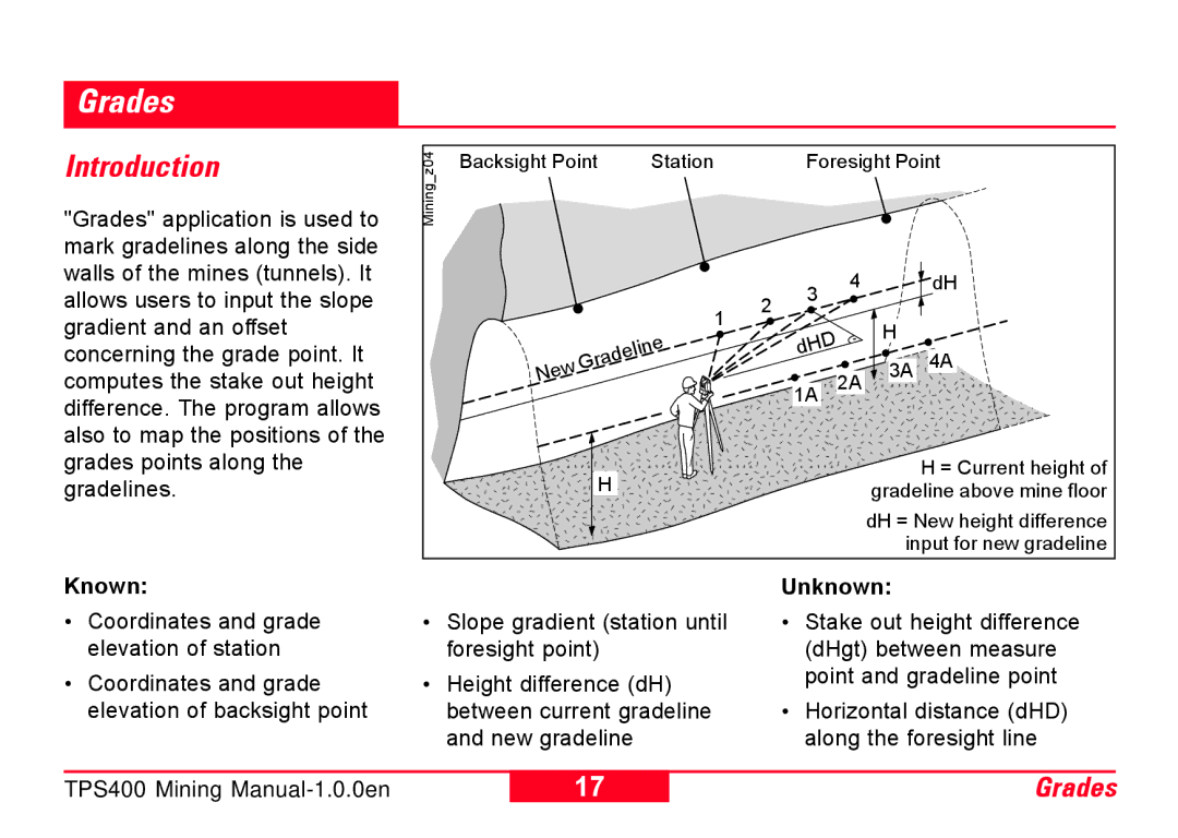
"Grades" application is used to mark gradelines along the side
z04 | Backsight Point | Station | Foresight Point |
Mining_ |
|
|
|
walls of the mines (tunnels). It allows users to input the slope gradient and an offset
1 2 3
4
![]() dH
dH
H
concerning the grade point. It computes the stake out height difference. The program allows also to map the positions of the grades points along the gradelines.
New | Gradeline |
|
H
dHD
1A 2A
![]() 3A 4A
3A 4A
H = Current height of gradeline above mine floor
dH = New height difference input for new gradeline
Known:
•Coordinates and grade elevation of station
•Coordinates and grade elevation of backsight point
•Slope gradient (station until foresight point)
•Height difference (dH) between current gradeline and new gradeline
Unknown:
•Stake out height difference (dHgt) between measure point and gradeline point
•Horizontal distance (dHD) along the foresight line
TPS400 Mining
17 | Grades |