Technical Specifications


Appendix A


Time Mark Output:


1PPS output aligned to GPS time ± 200 ns typical


PHYSICAL AND ENVIRONMENTAL


Dimensions:


115 mm Diameter x 90 mm Height


(4.5" Diameter x 3.6" Height)


Weight:


575 g maximum excluding cable (1.27 lb.)


Mounting:


1-14 UNS threads x 1” deep and/or


3 x 10-32 UNF screws


RS-232: weathertight, 7-pin plastic or 6-pin metal


Connectors:


RS-422: weathertight, 12-pin standard or cable mount


See Table 6, Connector Variations on Page 41


Temperature:


Operating: -30°C to +75°C (-22°F to 167°F)


Storage: -40°C to +85°C (-40°F to 185°F)


Humidity:


SAE J1455/4.2 procedure I/II


Waterproof:


Sealed unit meets MIL-STD 810E method 512.3 (equivalent to 6-foot, 30-


minute submersion)


Shock:


30 g IEC 68-2-27, Test Ea (11 ms pulse)


Vibration:


Sinusoidal:

4 g SAE J1211, Figure 4, 1.5 hours/axis


Random:

7.5 g MIL-STD 810F method 514.5 procedure I


Salt Spray:


MIL-STD 810E method 509.3 (48 hours)


Chemical Resistance:


Compatible with chemicals encountered in the heavy-duty trucking industry


Sand and Dust:


MIL-STD 810E method 510.3


ESD:


IEC 1000-4-2 level 2 (± 4 KV)


EMI:


FCC Class A, European CE, 89/EEC EN55022 class B, EN50082-1


Transient Protection:


SAE J1455 4.11.2 typical vehicle transient voltage characteristic power lines


(600 Watts, 1 m/s)


Ultraviolet Light Protection:


ASTM G53-88


SMART ANTENNA DEVELOPMENT KIT


SMART ANTENNA plus:


Interface cable


Bushing adapter


Accessories included:


Magnetic mount


AC/DC adapter


CD containing StarView software and user manuals


RS-422 to RS-232 converter (RS-422 models only)


a.Typical values. Performance specifications are subject to GPS system characteristics, U.S. DOD operational degrada- tion, ionospheric and tropospheric conditions, satellite geometry, baseline length and multipath effects. Assumes SA Off. Specifications subject to change without notice.

b.Limited by US and Canadian export laws

c.COM2 is also called DGPS IN

SMART ANTENNA User Manual Rev 6

37

Page 37
Image 37
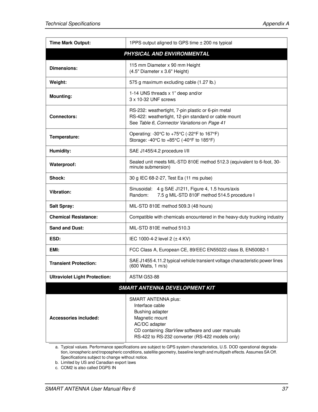
Novatel SMART ANTENNA user manual Technical Specifications Appendix a, Physical and Environmental

SMART ANTENNA specifications

The Novatel SMART ANTENNA represents a significant advancement in positioning technology, designed to meet the growing demands of various applications, including surveying, agriculture, and autonomous vehicles. Its compact, all-in-one design integrates GNSS (Global Navigation Satellite System) antennas, a GNSS receiver, and advanced signal processing capabilities into a single unit, thereby streamlining deployment and operation.

One of the standout features of the Novatel SMART ANTENNA is its multi-frequency capability, which allows it to utilize signals from various GNSS constellations, including GPS, GLONASS, Galileo, and BeiDou. This multi-constellation approach enhances reliability and accuracy, even in challenging environments where signal obstructions may occur. The ability to process signals across multiple frequencies significantly reduces the impact of multipath interference and improves positional precision.

The SMART ANTENNA employs sophisticated technologies, such as Real-Time Kinematic (RTK) positioning, which provides centimeter-level accuracy. This makes it ideal for applications that require high precision, such as land surveying or precision agriculture, where slight positional errors can lead to significant discrepancies in output.

Another important characteristic of the Novatel SMART ANTENNA is its rugged, weather-resistant design, making it suitable for a variety of outdoor environments. It has been engineered to withstand harsh weather conditions, ensuring operational reliability and longevity. This durability is crucial for industries that rely on continuous and accurate positioning data.

Moreover, the device features an easy-to-use interface, simplifying setup and operation for users of all experience levels. Its robust connectivity options, including Bluetooth and serial communications, enable seamless integration with various devices and systems, allowing for versatile usage across multiple platforms.

The Novatel SMART ANTENNA is also equipped with built-in monitoring and diagnostic tools, providing users with real-time feedback on performance metrics. This empowers users to maintain optimal operation and troubleshoot issues as they arise.

In summary, the Novatel SMART ANTENNA is a cutting-edge solution that combines advanced GNSS technology, accurate RTK positioning, and a rugged design. It is an unparalleled choice for industries that demand reliable and precise positioning data, driving efficiency and enhancing workflow across various applications.