3.5 Displaying Navigation Data
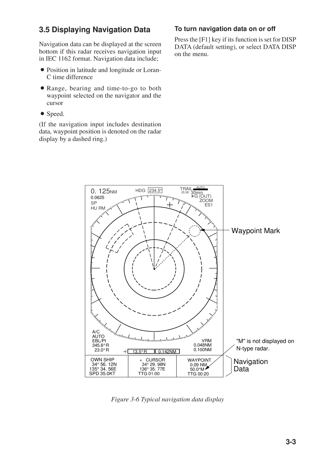
Navigation data can be displayed at the screen bottom if this radar receives navigation input in IEC 1162 format. Navigation data include;
ÁPosition in latitude and longitude or Loran- C time difference
ÁRange, bearing and
ÁSpeed.
(If the navigation input includes destination data, waypoint position is denoted on the radar display by a dashed ring.)
To turn navigation data on or off
Press the [F1] key if its function is set for DISP DATA (default setting), or select DATA DISP on the menu.
0. 125NM | HDG 234.5° |
0.0625 |
|
SP |
|
HU RM |
|
TRAIL AUTO
25:38 30min
![]() G (OUT)
G (OUT)
ZOOM
ES1
 Waypoint Mark
A/C |
|
|
|
AUTO |
|
| VRM |
EBL/PI |
|
| |
345.6°R |
|
| 0.048NM |
23.0°R | 13.5°R | 0.142NM | 0.100NM |
|
| ||
OWN SHIP | + CURSOR | WAYPOINT | |
34° 56. 12N | 34° 29. 98N | 0.09 NM | |
135° 34. 56E | 136° 35. 77E | 50.0°M | |
SPD 35.0KT | TTG 01:00 | TTG 00:20 | |
"M" is not displayed on
Navigation
Data
