SANTACRUZ
BtlG: t18.0Nltrl | - | 316€1 |
B B G : 2 2 5 M | P | 1 2 : 1 5 : 5 2 |
rxY | 1xn |
| XTE: o . ooNu |
| NAVIGATETO |
RNG: t18.0 NM | WAYPOINTS |
B R G : 2 2 5 M |
|
| SANTACRUZ |
| FTNTilFFEIF{*iT |
1 Xrt
MENUI ESC A I V I E N T R
SAN FRANCISCO
RNG: tt8.0NM | - | 31491 |
8RG:225M | - | 12:'15:52 |
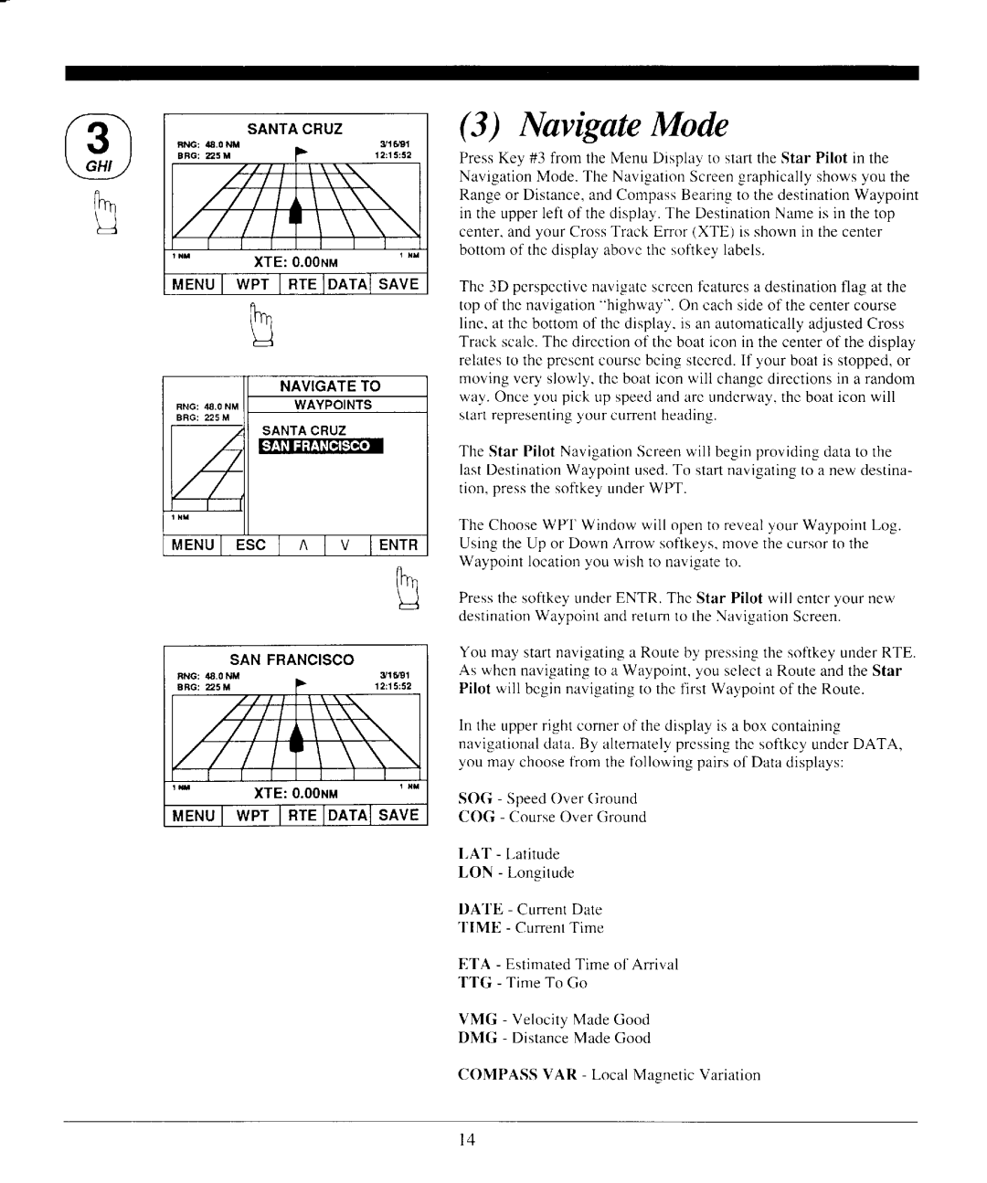
(3) IYavigateMode
PressKey #3 from the Menu Display to startthe Star Pilot in the NavigationMode.The NavigationScreengraphicallyshowsyou the Rangeor Distance,andCompassBearingto thedestinationWaypoint in the upperleft of thedisplay.The DestinationNameis in thetop center,andyour CrossTrack Error (XTE) is shownin the center bottomof thedisplayabovethesoftkeylabels.
The 3D
The Star Pilot NavigationScreenwill beginprovidingdatato the lastDestinationWaypointused.To startnavigatingto a new destina- tion, pressthe softkeyunderWPT.
The ChooseWPT Window will opento revealyour WaypointLog. UsingtheUp or Down Arrow softkeys,movethecursorto the Waypointlocationyou wish to navigateto.
PressthesofikeyunderENTR. The Star Pilot will enteryour new destinationWaypointandreturnto the NavigationScreen.
You may startnavigatinga Routeby pressingthe sofikeyunderRTE. As whennavigatingto a Waypoint,you selecta RouteandtheStar Pilot will beginnavigatingto thefirst Waypointof theRoute.
ln theupperrightcornerof thedisplayis a box containing navigationaldata.By alternatelypressingthesoftkeyunderDATA, you may choosefrom thefbllowingpairsof Datadisplays:
SOG - SpeedOverGround
COG - CourseOverGround
LAT - Latitude
LON - Longitude
DATE - CurrentDate
TIME - CurrentTime
ETA - EstimatedTime of Anival
TTG - Time To Go
VMG - VelocityMadeGood
DMG - DistanceMade Good
COMPASS VAR - Local MasneticVariation
l 4