User's manual BLUE Edition
3.4.2Representation of the map in navigation mode
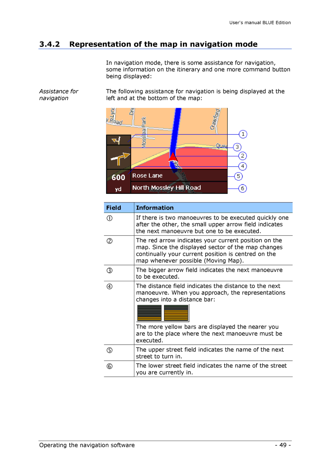
| In navigation mode, there is some assistance for navigation, |
| some information on the itinerary and one more command button |
| being displayed: |
Assistance for | The following assistance for navigation is being displayed at the |
navigation | left and at the bottom of the map: |
Field | Information |
|
|
| If there is two manoeuvres to be executed quickly one |
| after the other, the small upper arrow field indicates |
| the next manoeuvre but one to be executed. |
|
|
| The red arrow indicates your current position on the |
| map. Since the displayed sector of the map changes |
| continually your current position is centred on the |
| map whenever possible (Moving Map). |
|
|
| The bigger arrow field indicates the next manoeuvre |
| to be executed. |
|
|
| The distance field indicates the distance to the next |
| manoeuvre. When you approach, the representations |
| changes into a distance bar: |
| The more yellow bars are displayed the nearer you |
| are to the place where the next manoeuvre must be |
| executed. |
|
|
| The upper street field indicates the name of the next |
| street to turn in. |
|
|
| The lower street field indicates the name of the street |
| you are currently in. |
|
|
Operating the navigation software | - 49 - |