Preparing for Installation
The Satellite Locations
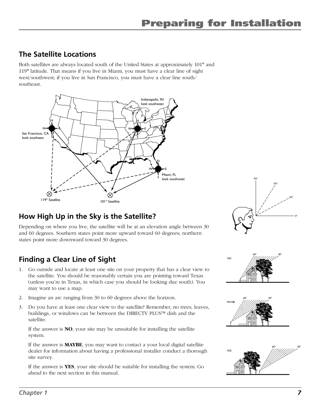
Both satellites are always located south of the United States at approximately 101° and 119° latitude. That means if you live in Miami, you must have a clear line of sight west/southwest; if you live in San Francisco, you must have a clear line south/ southeast.
Indianapolis, IN look southwest
| N |
| N |
W | E | W | E |
San Francisco, CA | S |
| S |
look southeast |
| ||
|
|
|
N
W![]()
![]() E
E
S
119° Satellite | 101° Satellite |
|
How High Up in the Sky is the Satellite?
Miami, FL
look southwest
90° |
60° |
30° |
0° |
Depending on where you live, the satellite will be at an elevation angle between 30 and 60 degrees. Southern states point more upward toward 60 degrees; northern states point more downward toward 30 degrees.
Finding a Clear Line of Sight
1.Go outside and locate at least one site on your property that has a clear view to the satellite. You should be reasonably certain you are pointing toward Texas (unless you’re in Texas, in which case you should be looking due south). You may want to use a map.
2.Imagine an arc ranging from 30 to 60 degrees above the horizon.
3.Do you have at least one clear view to the satellite? Remember, no trees, leaves, buildings, or windows can be between the DIRECTV PLUS™ dish and the satellite.
If the answer is NO, your site may be unsuitable for installing the satellite system.
If the answer is MAYBE, you may want to contact a your local digital satellite dealer for information about having a professional installer conduct a thorough site survey.
If the answer is YES, your site should be suitable for installing the system. Go ahead to the next section in this manual.
60°30°
NO
60°30°
MAYBE
60°30°
YES!
Chapter 1 | 7 |