1.RADAR MAP
2.Press the numeric key to select the number for desired mark.
For example, press the [1] [2] key in order when you want to select “●”.
3.Operate the trackball to move the cursor to the desired position.
4.Press the [ENTER] key. The selected mark is entered at the selected position.
5.Repeat step 2 through 4. When using the same mark, repeat step3 and 4.
6.Press the [MARK] key to close the menu.
When entering the line, follow the steps in below.
1.Press the [MARK] key to show ENTER MARK menu.
2.Press the numeric key to select the desired line.
No.14 through 20 are for line, the following table shows the shapes of No.16 through 20.
No./name 16 NAV LINE 17 COAST LINE
18CONTOUR LINE
19PROHIBITED AREAS
20 CABLE
Shape
White line
Shapes for lines
3.Operate the trackball to the position you want to enter the line.
4.Press the [ENTER] key.
Repeat step 3 and 4 to extend the same line. To change the line shapes, repeat step 2 through 4.
5.Press the [2] [1] [ENTER] in order to finish the entering line.
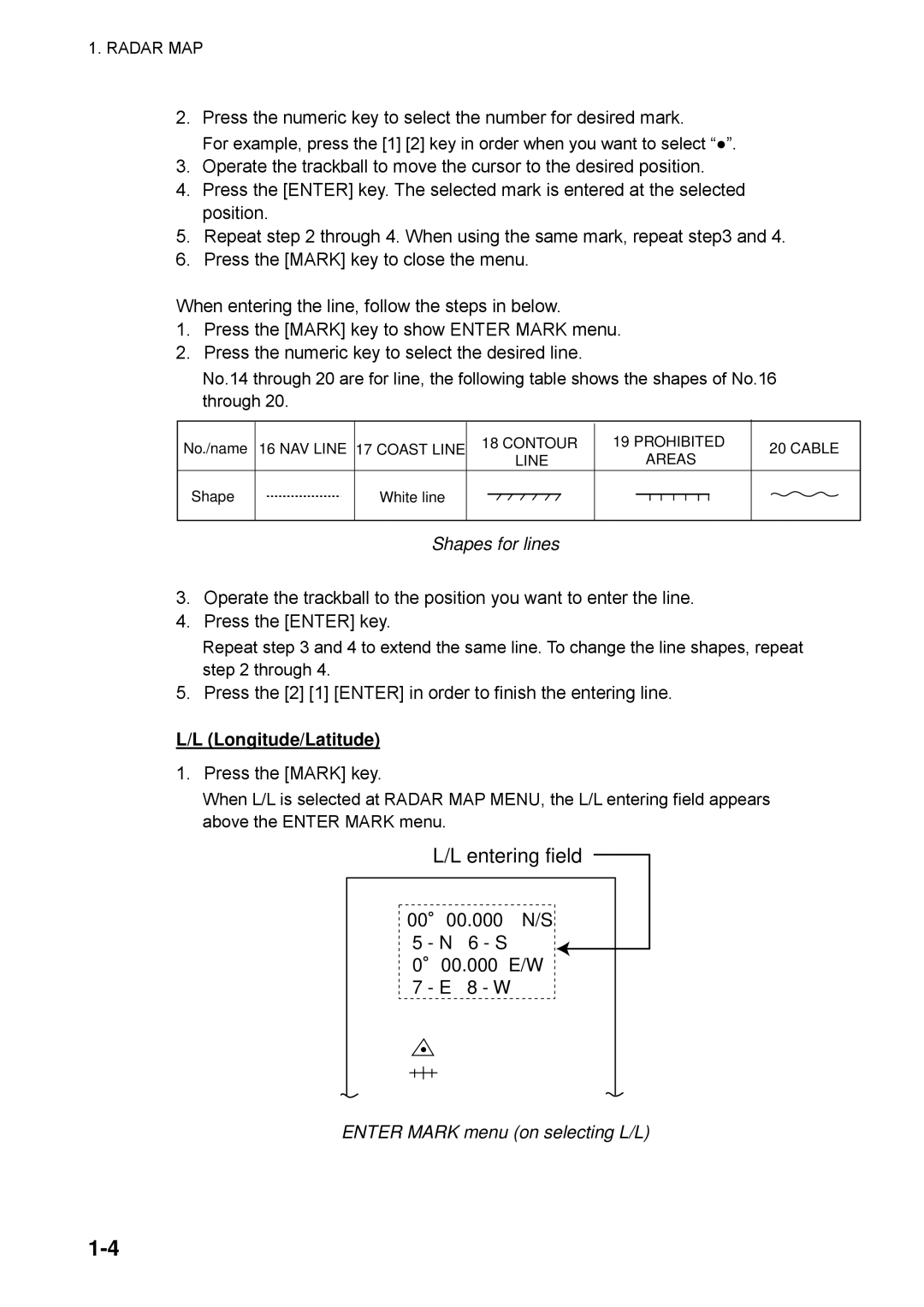
L/L (Longitude/Latitude)
1.Press the [MARK] key.
When L/L is selected at RADAR MAP MENU, the L/L entering field appears above the ENTER MARK menu.