Map view during route guidance
Map view during route guidance
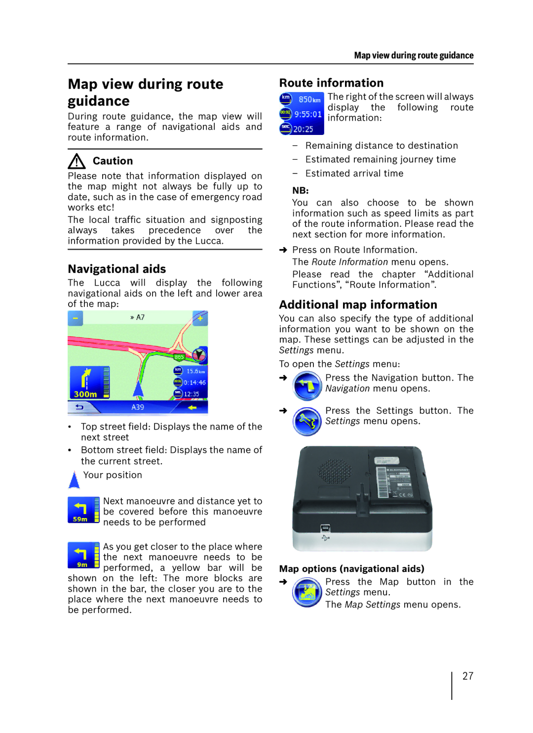
During route guidance, the map view will feature a range of navigational aids and route information.
Caution
Please note that information displayed on the map might not always be fully up to date, such as in the case of emergency road works etc!
The local traffic situation and signposting always takes precedence over the information provided by the Lucca.
Navigational aids
The Lucca will display the following navigational aids on the left and lower area of the map:
•Top street field: Displays the name of the next street
•Bottom street field: Displays the name of the current street.
![]() Your position
Your position
Next manoeuvre and distance yet to be covered before this manoeuvre needs to be performed
As you get closer to the place where the next manoeuvre needs to be performed, a yellow bar will be shown on the left: The more blocks are
shown in the bar, the closer you are to the place where the next manoeuvre needs to be performed.
Route information
The right of the screen will always display the following route information:
–Remaining distance to destination
–Estimated remaining journey time
–Estimated arrival time
NB:
You can also choose to be shown information such as speed limits as part of the route information. Please read the next section for more information.
➜Press on Route Information.
The Route Information menu opens. Please read the chapter “Additional Functions”, “Route Information”.
Additional map information
You can also specify the type of additional information you want to be shown on the map. These settings can be adjusted in the Settings menu.
To open the Settings menu:
➜Press the Navigation button. The Navigation menu opens.
➜Press the Settings button. The Settings menu opens.
Map options (navigational aids)
➜Press the Map button in the Settings menu.
The Map Settings menu opens.
27
