PiN Pocket PC 300 Quick Start Guide
GPS Status
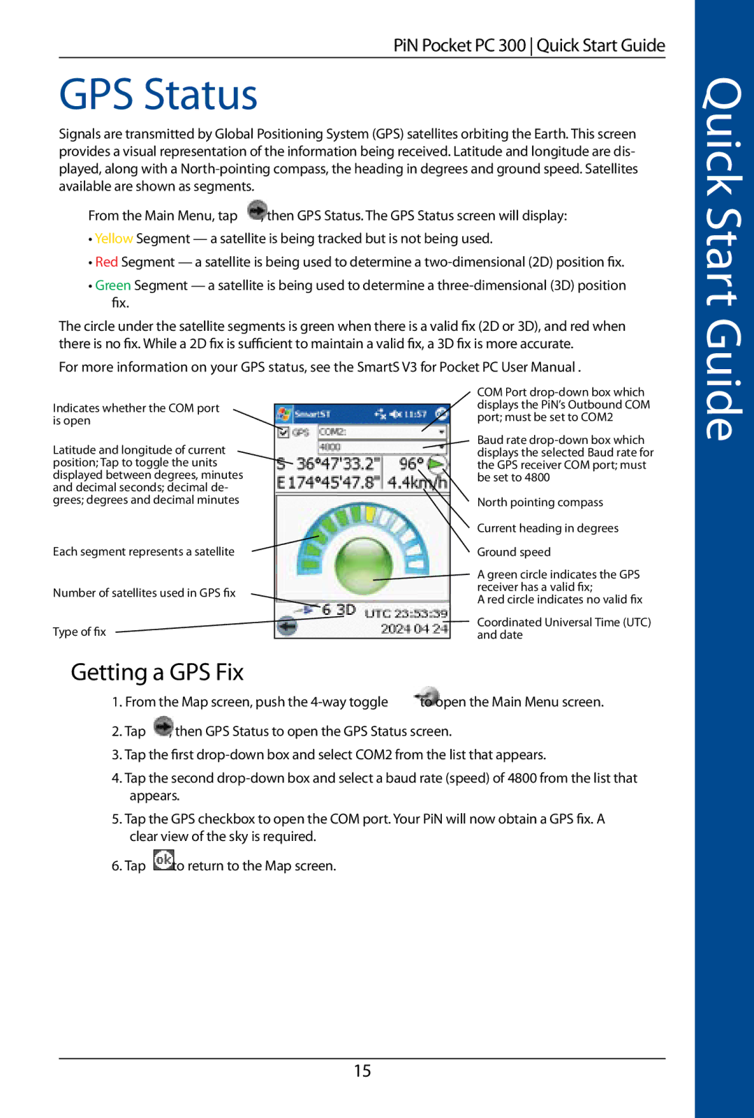
Signals are transmitted by Global Positioning System (GPS) satellites orbiting the Earth. This screen provides a visual representation of the information being received. Latitude and longitude are dis- played, along with a
From the Main Menu, tap | , then GPS Status. The GPS Status screen will display: |
•Yellow Segment — a satellite is being tracked but is not being used.
•Red Segment — a satellite is being used to determine a
•Green Segment — a satellite is being used to determine a
The circle under the satellite segments is green when there is a valid fix (2D or 3D), and red when there is no fix. While a 2D fix is sufficient to maintain a valid fix, a 3D fix is more accurate.
For more information on your GPS status, see the SmartS V3 for Pocket PC User Manual .
Quick Start Guide
Indicates whether the COM port is open
Latitude and longitude of current position; Tap to toggle the units displayed between degrees, minutes and decimal seconds; decimal de- grees; degrees and decimal minutes
Each segment represents a satellite
Number of satellites used in GPS fix
Type of fix
COM Port
Baud rate
North pointing compass
Current heading in degrees
Ground speed
A green circle indicates the GPS receiver has a valid fix;
A red circle indicates no valid fix
Coordinated Universal Time (UTC) and date
Getting a GPS Fix
1. From the Map screen, push the
2. Tap , then GPS Status to open the GPS Status screen.
3.Tap the first
4.Tap the second
5.Tap the GPS checkbox to open the COM port. Your PiN will now obtain a GPS fix. A clear view of the sky is required.
6.Tap ![]() to return to the Map screen.
to return to the Map screen.
15