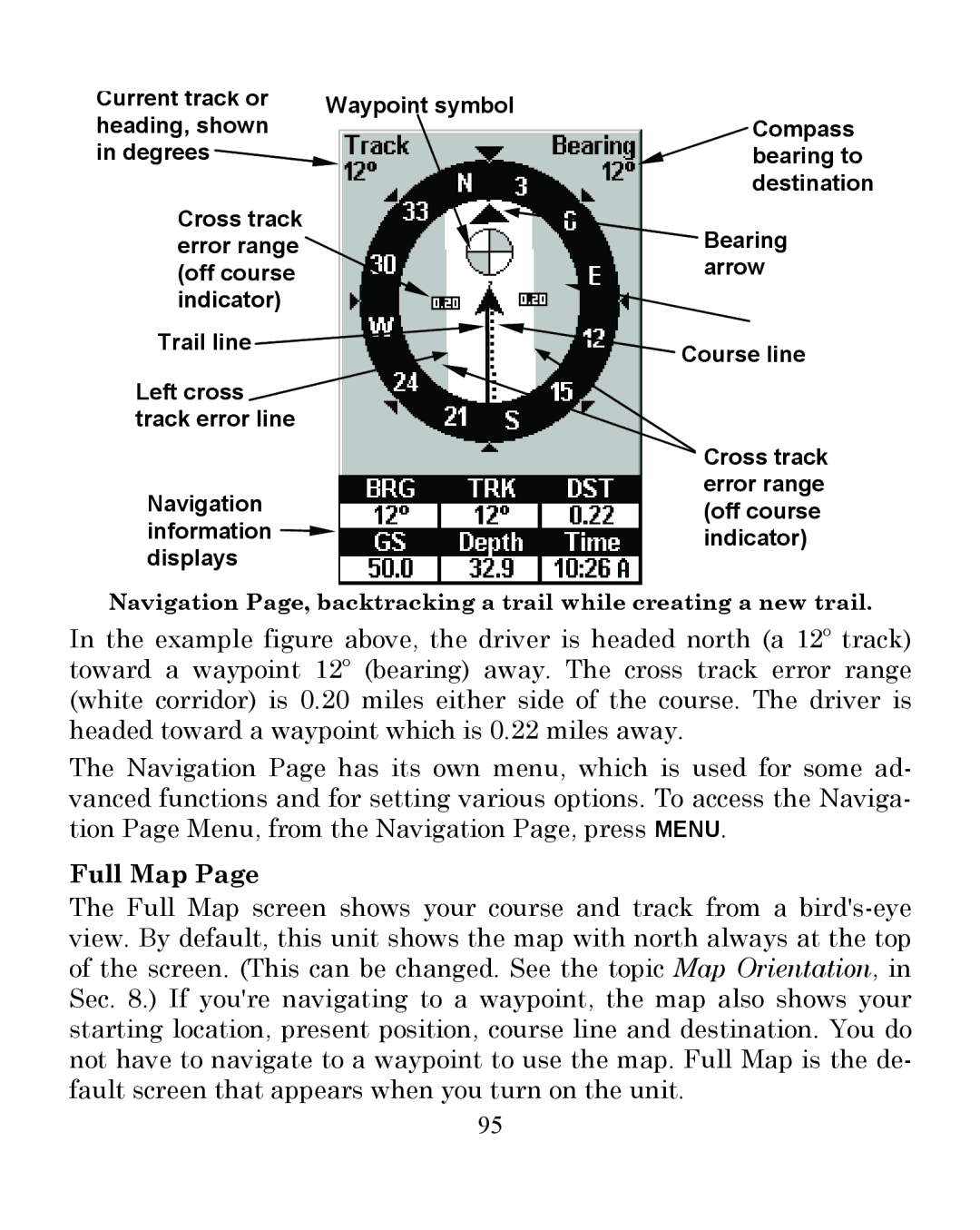
Current track or heading, shown in degrees
Cross track error range (off course indicator)
Waypoint symbol
Compass bearing to destination
![]() Bearing arrow
Bearing arrow
Trail line ![]()
![]() Course line
Course line
Left cross track error line
| Cross track |
Navigation | error range |
(off course | |
information | indicator) |
displays |
|
Navigation Page, backtracking a trail while creating a new trail.
In the example figure above, the driver is headed north (a 12º track) toward a waypoint 12º (bearing) away. The cross track error range (white corridor) is 0.20 miles either side of the course. The driver is headed toward a waypoint which is 0.22 miles away.
The Navigation Page has its own menu, which is used for some ad- vanced functions and for setting various options. To access the Naviga- tion Page Menu, from the Navigation Page, press MENU.
Full Map Page
The Full Map screen shows your course and track from a
95