Page
Page
Full Map
Page
Map with Sonar
GPS Quick Reference
Moving Around the Map Zoom & Cursor Arrow Keys
Find Your Current Position
100
101
Selecting Any Map Item With the Cursor
Set a Waypoint
To create and save a Waypoint
102
103
Navigate To a Waypoint
Set Man Overboard MOB Waypoint
Navigate Back to MOB Waypoint
104
105
Navigate to Cursor Position on Map
106
Navigate to a Map Place
Creating and Saving a Trail
107
108
To Save a Trail
109
Displaying a Saved Trail
110
Navigating Trails
To turn trail display on or off
Visual Trailing
111
Navigate a Trail forward
112
Cancel Navigation
Navigate a Back Trail backtrack, or reverse
113
Find Distance from Current Position
Find Distance from Point to Point
114
Icons
Create Icon on Map
115
Create Icon at Current Position
Delete an Icon
116
117
Navigate to an Icon
Routes
Create and Save a Route
118
119
120
Delete a Route
Edit a Route
121
122
Navigate a Route
123
124
Trails
Navigate a Route in Reverse
Delete a Trail
125
Alarm Clock
Utilities
Edit a Trail Name
Waypoints
Selecting a Waypoint
Set a Waypoint by Average Position
127
128
Set a Waypoint by Projecting a Position
129
GPS Setup Options
130
Auto Satellite Search
131
Coordinate System Selection
132
133
To setup Loran TD
To configure a map fix
Map Fix
134
Customize Page Displays
Customize Position
135
136
GPS Simulator
Customize Map or Navigation
To get to the GPS Simulator
137
Simulating Trail or Route Navigation
Initialize GPS
Map Auto Zoom
138
Pop-up Map Info
Map Data
To get to Map Data
Earth Map Detail
Map Datum Selection
Map Overlays Range Rings Lat/Long Grid
140
Map Detail Category Selection
To get to Map Categories
141
142
Map Orientation
143
144
145
146
Pop-up Help
To adjust the displays contrast
Screen Contrast and Brightness
147
Set Local Time
To adjust the displays brightness
To adjust the screens display mode
Set Language
149
Show Waas Alarm
To turn off Waas alarm
Software Version Information
150
151
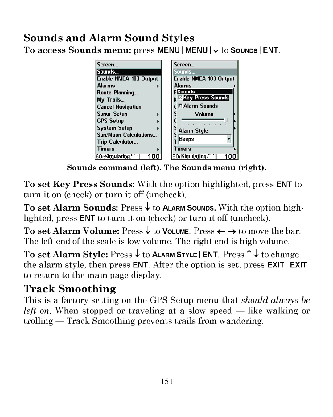
Sounds and Alarm Sound Styles
To access Sounds menu press MENUMENU↓ to Soundsent
Track Smoothing
To access the Trails Menu
Trail Options
152
153
To Update Active Trail
Trail Update Rate Time, Distance
Delete All Trails
154
Delete Trail
To change units of measure
Units of Measure
New Trail
Trail Visible/Invisible and Other Trail Options
156
Nmea 0183 Connections
157
158
159
160
Communications Port Configuration
Communications Port Activation
161
162
163
Configure Nmea
164
Compatibility with Various VHF Radios
Page
Page
Page
165
FCC Compliance
Eagle Electronics
Not toll-free
How to Obtain Service…
Accessory Ordering Information for all countries
Visit our web site