Lowrance electronic LCX-20C manual 102

Models: LCX-20C

1 200
Download 200 pages 4.97 Kb
Page 110
Image 110

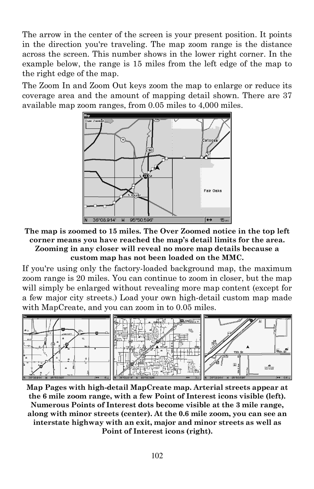
The arrow in the center of the screen is your present position. It points in the direction you're traveling. The map zoom range is the distance across the screen. This number shows in the lower right corner. In the example below, the range is 15 miles from the left edge of the map to the right edge of the map.

The Zoom In and Zoom Out keys zoom the map to enlarge or reduce its coverage area and the amount of mapping detail shown. There are 37 available map zoom ranges, from 0.05 miles to 4,000 miles.

The map is zoomed to 15 miles. The Over Zoomed notice in the top left corner means you have reached the map’s detail limits for the area.

Zooming in any closer will reveal no more map details because a

custom map has not been loaded on the MMC.

If you're using only the factory-loaded background map, the maximum zoom range is 20 miles. You can continue to zoom in closer, but the map will simply be enlarged without revealing more map content (except for a few major city streets.) Load your own high-detail custom map made with MapCreate, and you can zoom in to 0.05 miles.

Map Pages with high-detail MapCreate map. Arterial streets appear at the 6 mile zoom range, with a few Point of Interest icons visible (left). Numerous Points of Interest dots become visible at the 3 mile range, along with minor streets (center). At the 0.6 mile zoom, you can see an interstate highway with an exit, major and minor streets as well as Point of Interest icons (right).

102

Page 110
Image 110
Lowrance electronic LCX-20C manual 102