Landmarks | On | On | Off | Off |
Cultural Features | On | Off | Off | Off |
Lat/Lon Grid | On | Off | On | Off |
Chart Boundaries | On | Auto | Off | Off |
Cartography | On | On | Off | On |
Mixing Levels | On | Off | On | Off |
Objects Overlap | Off | On | Off | On |
1.To change to one of the
2.Move the ShuttlePoint knob to CHART SETUP and press [ENTER].
3.Move the Shuttlepoint knob to PRESETS and press [ENTER].
4.Move the ShuttlePoint knob up or down to select the desired preset and press [ENTER].
5.Press [CLEAR] or move the ShuttlePoint knob to the right until the Chart Page is shown.
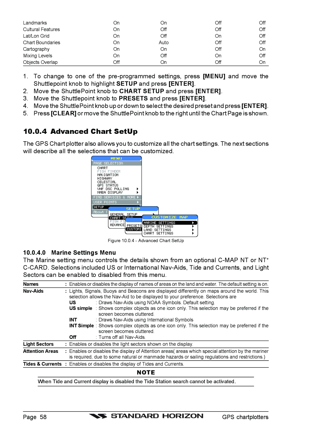
10.0.4 Advanced Chart SetUp
The GPS Chart plotter also allows you to customize all the chart settings. The next sections will describe all the selections that can be customized.
Figure 10.0.4 - Advanced Chart SetUp
10.0.4.0 Marine Settings Menu
The Marine setting menu controls the details shown from an optional
Names | : Enables or disables the display of names of areas on the land and water. The default setting is on. | |
| : Lights, Signals, Buoys and Beacons are displayed differently on maps around the world. This | |
| selection allows the | |
| US | : Draws |
| US simple : Shows complex objects as one icon only. This selection may be preferred if the | |
|
| screen becomes cluttered. |
| INT | : Draws |
| INT Simple : Shows complex objects as one icon only. This selection may be preferred if the | |
|
| screen becomes cluttered. |
| Off | : Turns off all |
Light Sectors | : Enables or disables the light sectors shown on the display. | |
Attention Areas | : Enables or disables the display of Attention areas( areas which special attention by the mariner | |
| is required, due to some natural or manmade hazards or sailing regulations and restrictions.) | |
Tides & Currents : Enables or disables the display of Tides and Currents.
NOTE
When Tide and Current display is disabled the Tide Station search cannot be activated.
Page 58 |
| GPS chartplotters |
|