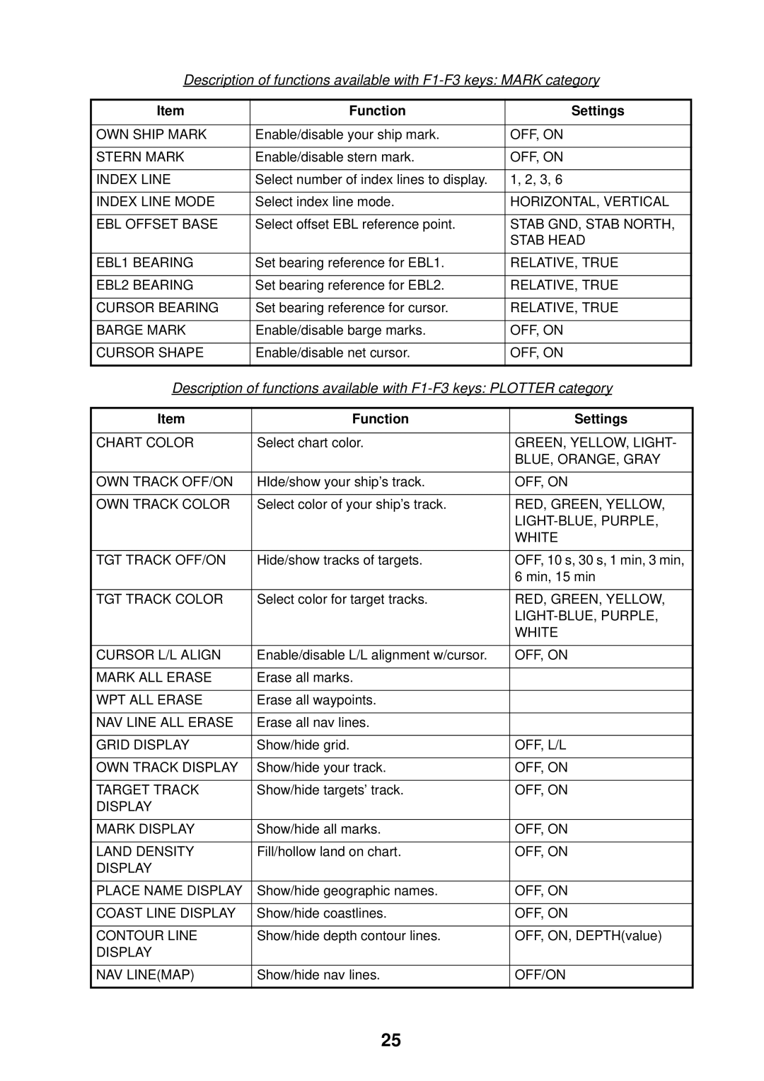
Description of functions available with
Item | Function |
| Settings |
|
|
|
|
OWN SHIP MARK | Enable/disable your ship mark. |
| OFF, ON |
|
|
|
|
STERN MARK | Enable/disable stern mark. |
| OFF, ON |
|
|
|
|
INDEX LINE | Select number of index lines to display. | 1, 2, 3, 6 | |
|
|
|
|
INDEX LINE MODE | Select index line mode. |
| HORIZONTAL, VERTICAL |
|
|
|
|
EBL OFFSET BASE | Select offset EBL reference point. |
| STAB GND, STAB NORTH, |
|
|
| STAB HEAD |
|
|
|
|
EBL1 BEARING | Set bearing reference for EBL1. |
| RELATIVE, TRUE |
|
|
|
|
EBL2 BEARING | Set bearing reference for EBL2. |
| RELATIVE, TRUE |
|
|
|
|
CURSOR BEARING | Set bearing reference for cursor. |
| RELATIVE, TRUE |
|
|
|
|
BARGE MARK | Enable/disable barge marks. |
| OFF, ON |
|
|
|
|
CURSOR SHAPE | Enable/disable net cursor. |
| OFF, ON |
|
|
|
|
Description of functions available with | |||
|
|
|
|
Item | Function |
| Settings |
|
|
|
|
CHART COLOR | Select chart color. |
| GREEN, YELLOW, LIGHT- |
|
|
| BLUE, ORANGE, GRAY |
|
|
|
|
OWN TRACK OFF/ON | HIde/show your ship’s track. |
| OFF, ON |
|
|
|
|
OWN TRACK COLOR | Select color of your ship’s track. |
| RED, GREEN, YELLOW, |
|
|
| |
|
|
| WHITE |
|
|
|
|
TGT TRACK OFF/ON | Hide/show tracks of targets. |
| OFF, 10 s, 30 s, 1 min, 3 min, |
|
|
| 6 min, 15 min |
|
|
|
|
TGT TRACK COLOR | Select color for target tracks. |
| RED, GREEN, YELLOW, |
|
|
| |
|
|
| WHITE |
|
|
|
|
CURSOR L/L ALIGN | Enable/disable L/L alignment w/cursor. |
| OFF, ON |
|
|
|
|
MARK ALL ERASE | Erase all marks. |
|
|
|
|
|
|
WPT ALL ERASE | Erase all waypoints. |
|
|
|
|
|
|
NAV LINE ALL ERASE | Erase all nav lines. |
|
|
|
|
|
|
GRID DISPLAY | Show/hide grid. |
| OFF, L/L |
|
|
|
|
OWN TRACK DISPLAY | Show/hide your track. |
| OFF, ON |
|
|
|
|
TARGET TRACK | Show/hide targets’ track. |
| OFF, ON |
DISPLAY |
|
|
|
|
|
|
|
MARK DISPLAY | Show/hide all marks. |
| OFF, ON |
|
|
|
|
LAND DENSITY | Fill/hollow land on chart. |
| OFF, ON |
DISPLAY |
|
|
|
|
|
|
|
PLACE NAME DISPLAY | Show/hide geographic names. |
| OFF, ON |
|
|
|
|
COAST LINE DISPLAY | Show/hide coastlines. |
| OFF, ON |
|
|
|
|
CONTOUR LINE | Show/hide depth contour lines. |
| OFF, ON, DEPTH(value) |
DISPLAY |
|
|
|
|
|
|
|
NAV LINE(MAP) | Show/hide nav lines. |
| OFF/ON |
|
|
|
|
25
