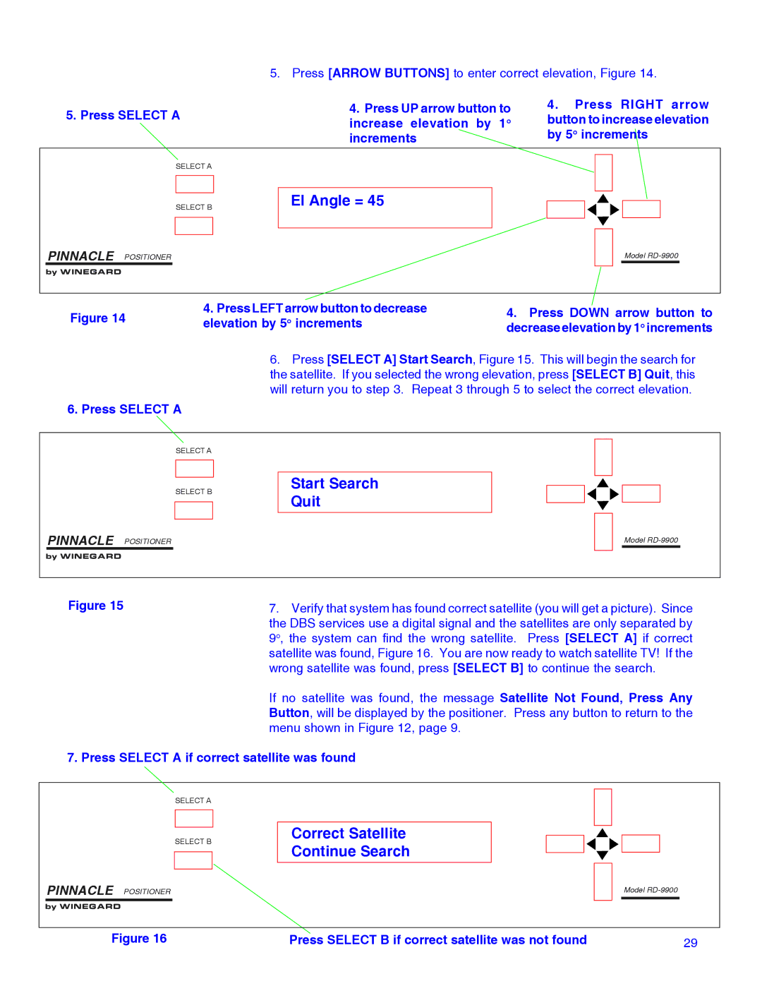
5. Press [ARROW BUTTONS] to enter correct elevation, Figure 14.
5. Press SELECT A | 4. Press UP arrow button to | |
increase elevation by 1o | ||
| ||
| increments |
4.Press RIGHT arrow button to increase elevation by 5o increments
SELECT A
SELECT B
El Angle = 45
PINNACLE POSITIONER
by WINEGARD
Model
Figure 14 | 4. Press LEFT arrow button to decrease | 4. Press DOWN arrow button to | |
elevation by 5o increments | |||
decrease elevation by 1o increments |
6. Press [SELECT A] Start Search, Figure 15. This will begin the search for the satellite. If you selected the wrong elevation, press [SELECT B] Quit, this will return you to step 3. Repeat 3 through 5 to select the correct elevation.
6. Press SELECT A
SELECT A
SELECT B
PINNACLE POSITIONER
by WINEGARD
Start Search Quit
Model
Figure 15 | 7. Verify that system has found correct satellite (you will get a picture). Since |
| the DBS services use a digital signal and the satellites are only separated by |
| 9o, the system can find the wrong satellite. Press [SELECT A] if correct |
| satellite was found, Figure 16. You are now ready to watch satellite TV! If the |
| wrong satellite was found, press [SELECT B] to continue the search. |
| If no satellite was found, the message Satellite Not Found, Press Any |
| Button, will be displayed by the positioner. Press any button to return to the |
| menu shown in Figure 12, page 9. |
7. Press SELECT A if correct satellite was found
SELECT A
SELECT B
PINNACLE POSITIONER
by WINEGARD
Correct Satellite Continue Search
Model
Figure 16 | Press SELECT B if correct satellite was not found | 29 |
