3. ADVANCED OPERATON
Now that you are familiar with the basic key operation of the CP150C, we will discuss the more advance operations in detail.
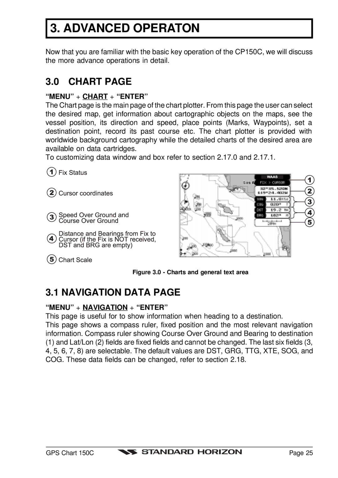
3.0 CHART PAGE
“MENU” + CHART + “ENTER”
The Chart page is the main page of the chart plotter. From this page the user can select the desired map, get information about cartographic objects on the maps, see the vessel position, its direction and speed, place points (Marks, Waypoints), set a destination point, record its past course etc. The chart plotter is provided with worldwide background cartography while the detailed charts of the desired area are available on data cartridges.
To customizing data window and box refer to section 2.17.0 and 2.17.1.
Figure 3.0 - Charts and general text area
3.1 NAVIGATION DATA PAGE
“MENU” + NAVIGATION + “ENTER”
This page is useful for to show information when heading to a destination.
This page shows a compass ruler, fixed position and the most relevant navigation information. Compass ruler showing Course Over Ground and Bearing to destination
(1)and Lat/Lon (2) fields are fixed fields and cannot be changed. The last six fields (3, 4, 5, 6, 7, 8) are selectable. The default values are DST, GRG, TTG, XTE, SOG, and COG. These data fields can be changed, refer to section 2.18.
GPS Chart 150C |
| Page 25 |
|