Navigation System
There are two icons on the left to show the status of the GPS connection and the qual- ity of reception.
GPS Connection Indicator
In the middle to the left there is a lamp similar to the ones used for switches. This one has more colors and represents more values:
•A fast blinking green lamp means that there is communication with the GPS and data is being received,
•Other colors may not appear with a built- in GPS. Should any of these appear, this means a faulty operation of your device.
GPS Data Quality Indicator
In the top left corner there is a satellite dish to show the quality of the GPS position. Different colors represent different signal quality:
•black with a red cross means there is no connection with the GPS device. This should never be the case if your device has a
•red means the GPS is connected but no GPS position is available,
•yellow means 2D reception. A GPS posi- tion has been acquired, Cydle is ready for navigation, but the GPS is using enough satellites for calculating the horizontal po- sition only. Elevation data is not provided, and the position error may be significant.
•green means 3D reception. The GPS re- ceiver has enough satellites to calculate altitude. Position is generally correct (yet it can still be inaccurate due to different environmental factors). Cydle is ready for navigation.
Time Synchronization
In the top right corner of the screen you have another button that leads to a new screen where you can synchronize the clock of your VRVD640G to the very accurate time provided by the connected GPS.
Turn on the Auto Correction switch to let Cydle frequently check and correct the
VRVD640G time with the GPS time. Below that button you will see the cur- rent values of the GPS and the VRVD640G clocks. You can check here whether any correction is needed. Touch the button to manually synchronize the time.
Below the VRVD640G time you have hour and minute controls to manually cor- rect the time with or without a valid GPS time. It also gives you the chance to cor- rect the time after synchronization if your VRVD640G does not support time zones or daylight saving time.
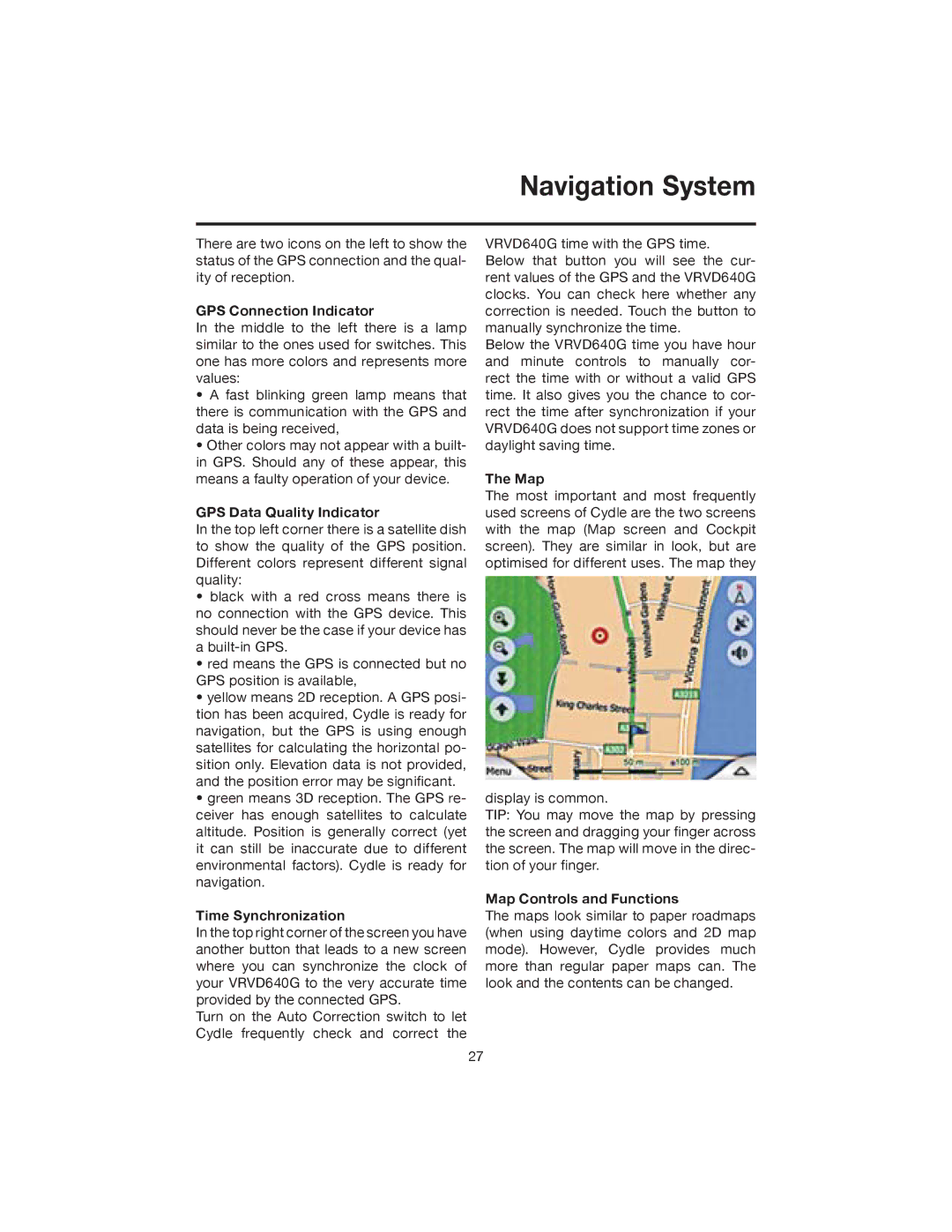
The Map
The most important and most frequently used screens of Cydle are the two screens with the map (Map screen and Cockpit screen). They are similar in look, but are optimised for different uses. The map they
display is common.
TIP: You may move the map by pressing the screen and dragging your finger across the screen. The map will move in the direc- tion of your finger.
Map Controls and Functions
The maps look similar to paper roadmaps (when using daytime colors and 2D map mode). However, Cydle provides much more than regular paper maps can. The look and the contents can be changed.
27