4.2Waypoint Selection and Management
Similar to Data Management, the Navigation context menu changes depending on whether data is selected.
When features or nodes have not been selected, the context menu provides the user with access to:
1.Waypoint Management which provides a list of features or nodes flagged as Waypoints.
2.Select from Clipboard if a node was previously copied from Data Management.
If a feature is selected, the context menu then provides Waypoint with the options for the feature or node to be:
•Flagged as a Waypoint.
•Flag a point as 2 Visited once it has been navigated to.
•Access back to the 3 Waypoint Management.
•Select the 4 Previous or 5 Next Waypoint feature.
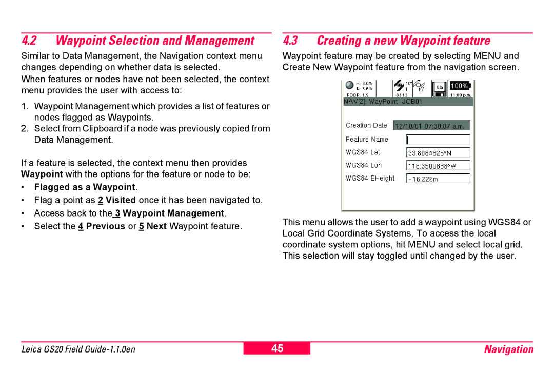
4.3Creating a new Waypoint feature
Waypoint feature may be created by selecting MENU and Create New Waypoint feature from the navigation screen.
This menu allows the user to add a waypoint using WGS84 or Local Grid Coordinate Systems. To access the local coordinate system options, hit MENU and select local grid. This selection will stay toggled until changed by the user.
Leica GS20 Field
45
Navigation