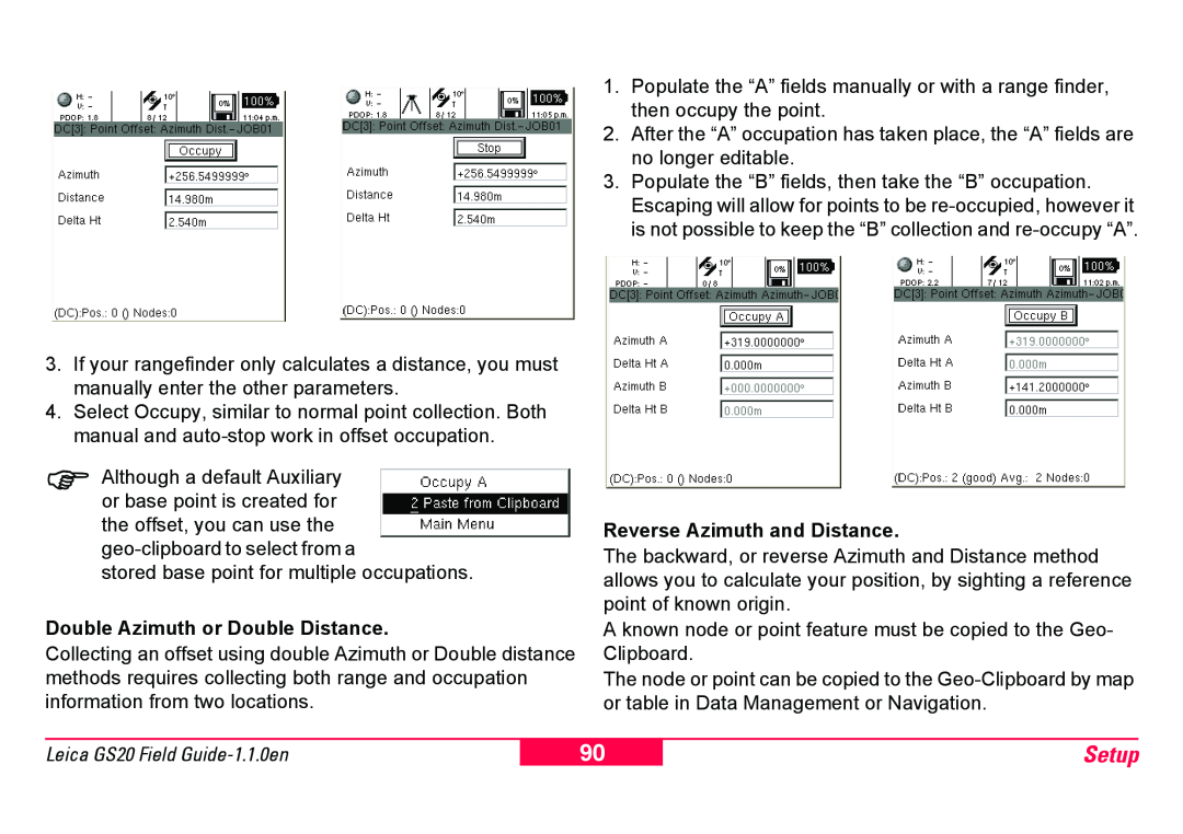
3.If your rangefinder only calculates a distance, you must manually enter the other parameters.
4.Select Occupy, similar to normal point collection. Both manual and
)Although a default Auxiliary or base point is created for the offset, you can use the
stored base point for multiple occupations.
Double Azimuth or Double Distance.
Collecting an offset using double Azimuth or Double distance methods requires collecting both range and occupation information from two locations.
1.Populate the “A” fields manually or with a range finder, then occupy the point.
2.After the “A” occupation has taken place, the “A” fields are no longer editable.
3.Populate the “B” fields, then take the “B” occupation. Escaping will allow for points to be
Reverse Azimuth and Distance.
The backward, or reverse Azimuth and Distance method allows you to calculate your position, by sighting a reference point of known origin.
A known node or point feature must be copied to the Geo- Clipboard.
The node or point can be copied to the
Leica GS20 Field
90
Setup