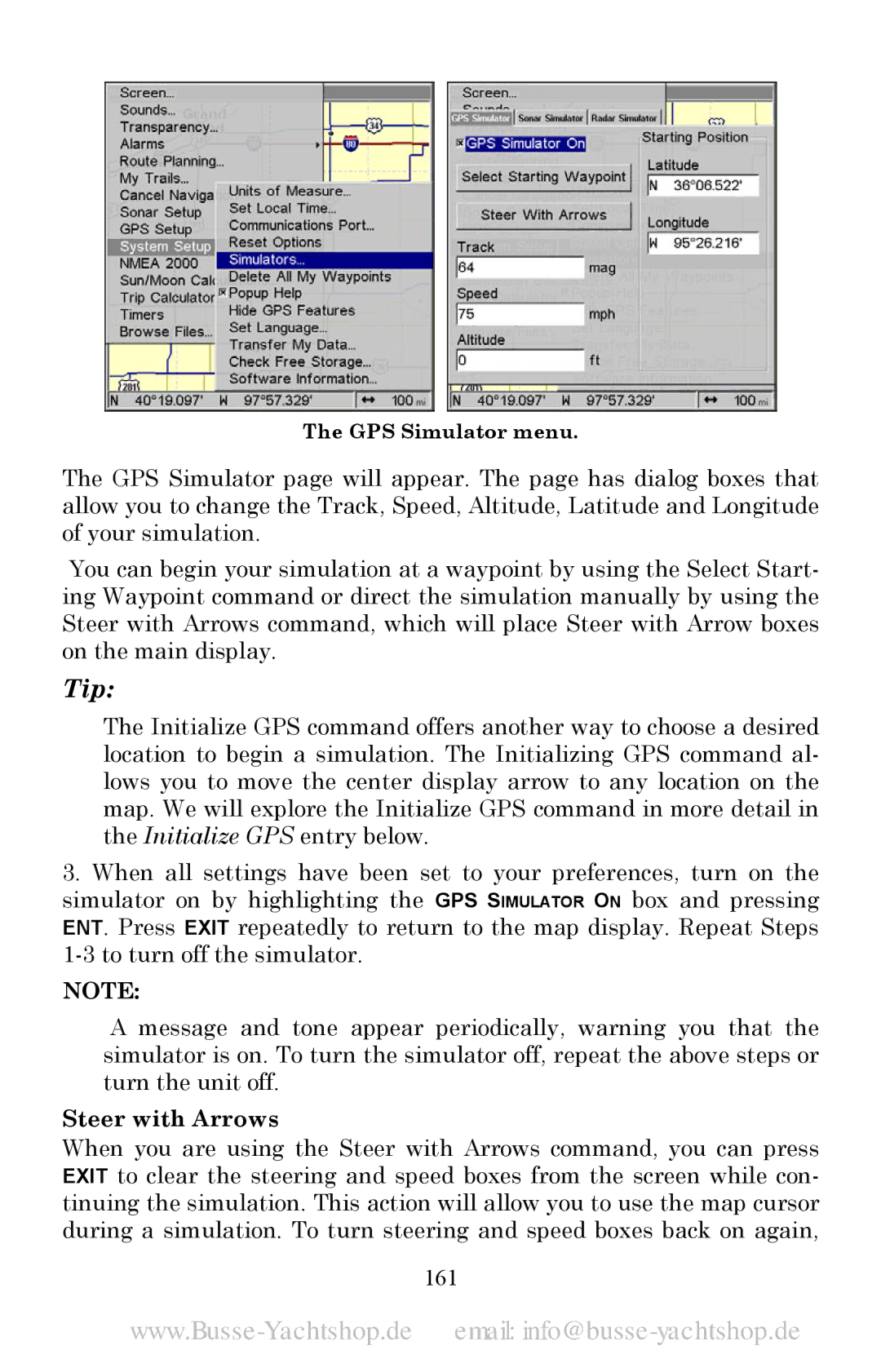
The GPS Simulator menu.
The GPS Simulator page will appear. The page has dialog boxes that allow you to change the Track, Speed, Altitude, Latitude and Longitude of your simulation.
You can begin your simulation at a waypoint by using the Select Start- ing Waypoint command or direct the simulation manually by using the Steer with Arrows command, which will place Steer with Arrow boxes on the main display.
Tip:
The Initialize GPS command offers another way to choose a desired location to begin a simulation. The Initializing GPS command al- lows you to move the center display arrow to any location on the map. We will explore the Initialize GPS command in more detail in the Initialize GPS entry below.
3.When all settings have been set to your preferences, turn on the simulator on by highlighting the GPS SIMULATOR ON box and pressing ENT. Press EXIT repeatedly to return to the map display. Repeat Steps
NOTE:
A message and tone appear periodically, warning you that the simulator is on. To turn the simulator off, repeat the above steps or turn the unit off.
Steer with Arrows
When you are using the Steer with Arrows command, you can press EXIT to clear the steering and speed boxes from the screen while con- tinuing the simulation. This action will allow you to use the map cursor during a simulation. To turn steering and speed boxes back on again,