| Raynav 300 GPS Plotter | |||
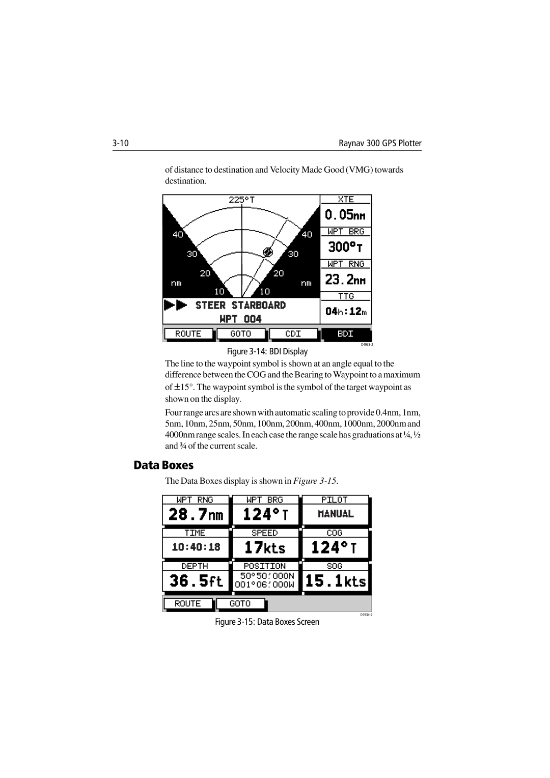
of distance to destination and Velocity Made Good (VMG) towards | ||||
destination. |
|
|
| |
|
|
|
| |
225°T |
| XTE |
| |
|
| 0.05nm |
| |
|
|
|
| |
40 | 40 | WPT BRG |
| |
300°T |
| |||
30 | 30 |
| ||
|
| |||
|
|
|
| |
|
| WPT RNG |
| |
20 | 20 | 23.2nm |
| |
nm | nm |
| ||
10 | 10 |
|
| |
TTG |
| |||
|
| |||
STEER STARBOARD
WPT 004
04h:12m
ROUTE GOTO CDI BDI
Figure 3-14: BDI Display
The line to the waypoint symbol is shown at an angle equal to the difference between the COG and the Bearing to Waypoint to a maximum of ±15°. The waypoint symbol is the symbol of the target waypoint as shown on the display.
Four range arcs are shown with automatic scaling to provide 0.4nm, 1nm, 5nm, 10nm, 25nm, 50nm, 100nm, 200nm, 400nm, 1000nm, 2000nm and 4000nm range scales. In each case the range scale has graduations at ¼, ½ and ¾ of the current scale.
Data Boxes
The Data Boxes display is shown in Figure
WPT RNG | WPT BRG | PILOT |
28.7nm 124°T MANUAL
TIME SPEED COG
10:40:18 17kts 124°T
DEPTH POSITION SOG 36.5ft 001°06^000W50°50^000N 15.1kts
ROUTE GOTO