RayTech Navigator User’s Guide
2.Type in a name (up to 13 characters including blanks) for your route, or click OK to accept the default name of “Qr.”
Note: Identical route names will overwrite each other without a confirmation warning.
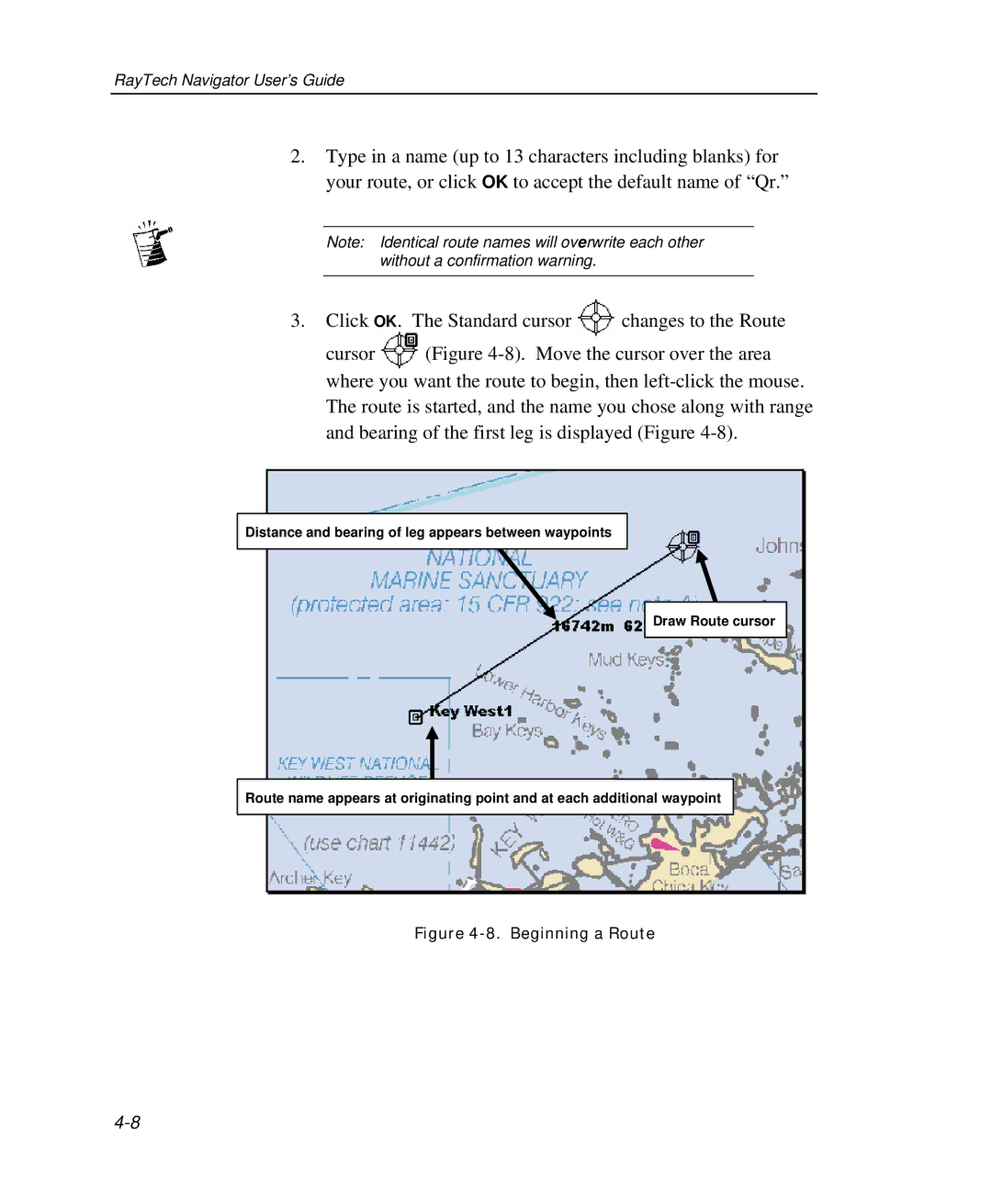
3.Click OK. The Standard cursor ![]() changes to the Route
changes to the Route
cursor ![]() (Figure
(Figure
The route is started, and the name you chose along with range and bearing of the first leg is displayed (Figure
Distance and bearing of leg appears between waypoints |
Draw Route cursor |
Route name appears at originating point and at each additional waypoint |
Figure |