RayTech Navigator User’s Guide
Connecting Directly to NMEA-Equipped Instruments
Most instrument systems are equipped to accept incoming NMEA data from your GPS, and will output additional collected NMEA data, such as vessel position, heading, speed, water depth, etc.
To connect Navigator directly to an
Table
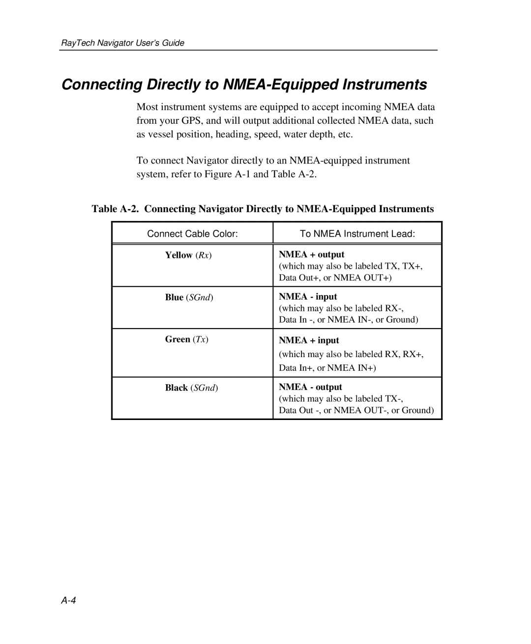
Connect Cable Color: | To NMEA Instrument Lead: |
|
|
|
|
Yellow (Rx) | NMEA + output |
| (which may also be labeled TX, TX+, |
| Data Out+, or NMEA OUT+) |
|
|
Blue (SGnd) | NMEA - input |
| (which may also be labeled |
| Data In |
|
|
Green (Tx) | NMEA + input |
| (which may also be labeled RX, RX+, |
| Data In+, or NMEA IN+) |
|
|
Black (SGnd) | NMEA - output |
| (which may also be labeled |
| Data Out |
|
|