Appendix
 Appendix
How do GPS and dead reckoning work together?
For maximum accuracy, your navigation sys- tem continually compares GPS data with your estimated position as calculated from the data of 3D Hybrid Sensor. However, if only the data from the 3D Hybrid Sensor is available for a long period, positioning errors are gradually compounded until the estimated position be- comes unreliable. For this reason, whenever GPS signals are available, they are matched with the data of the 3D Hybrid Sensor and used to correct it for improved accuracy.
To ensure maximum accuracy, the dead reck- oning system learns with experience. By com- paring the position it estimates with your actual position as obtained using GPS, it can correct for various types of error, such as tire wear and the rolling motion of your vehicle. As you drive, the dead reckoning system gradu- ally gathers more data, learns more, and the accuracy of its estimates gradually increases. So, after you have driven some distance, you can expect your position as shown on the map to show fewer errors.
pIf you use chains on your wheels for winter driving or put on the spare wheel, errors may suddenly increase because of differ- ence in wheel diameter. The system detects the fact that the tire diameter has changed,
and automatically replaces the value for calculating distance.
pIf
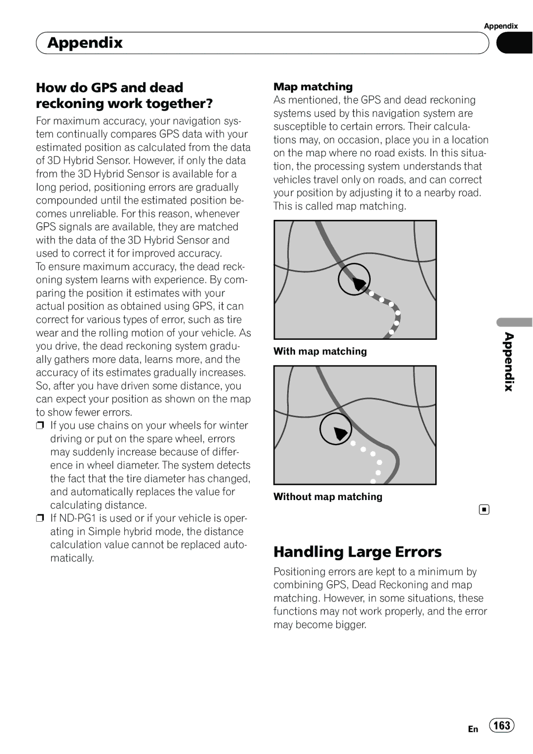
Map matching
As mentioned, the GPS and dead reckoning systems used by this navigation system are susceptible to certain errors. Their calcula- tions may, on occasion, place you in a location on the map where no road exists. In this situa- tion, the processing system understands that vehicles travel only on roads, and can correct your position by adjusting it to a nearby road. This is called map matching.
With map matching | Appendix |
|
Without map matching
Handling Large Errors
Positioning errors are kept to a minimum by combining GPS, Dead Reckoning and map matching. However, in some situations, these functions may not work properly, and the error may become bigger.
En 163