DSM250 User’s Manual
The allowable values for the Antenna Altitude are between
6.14.1.3Elevation Mask
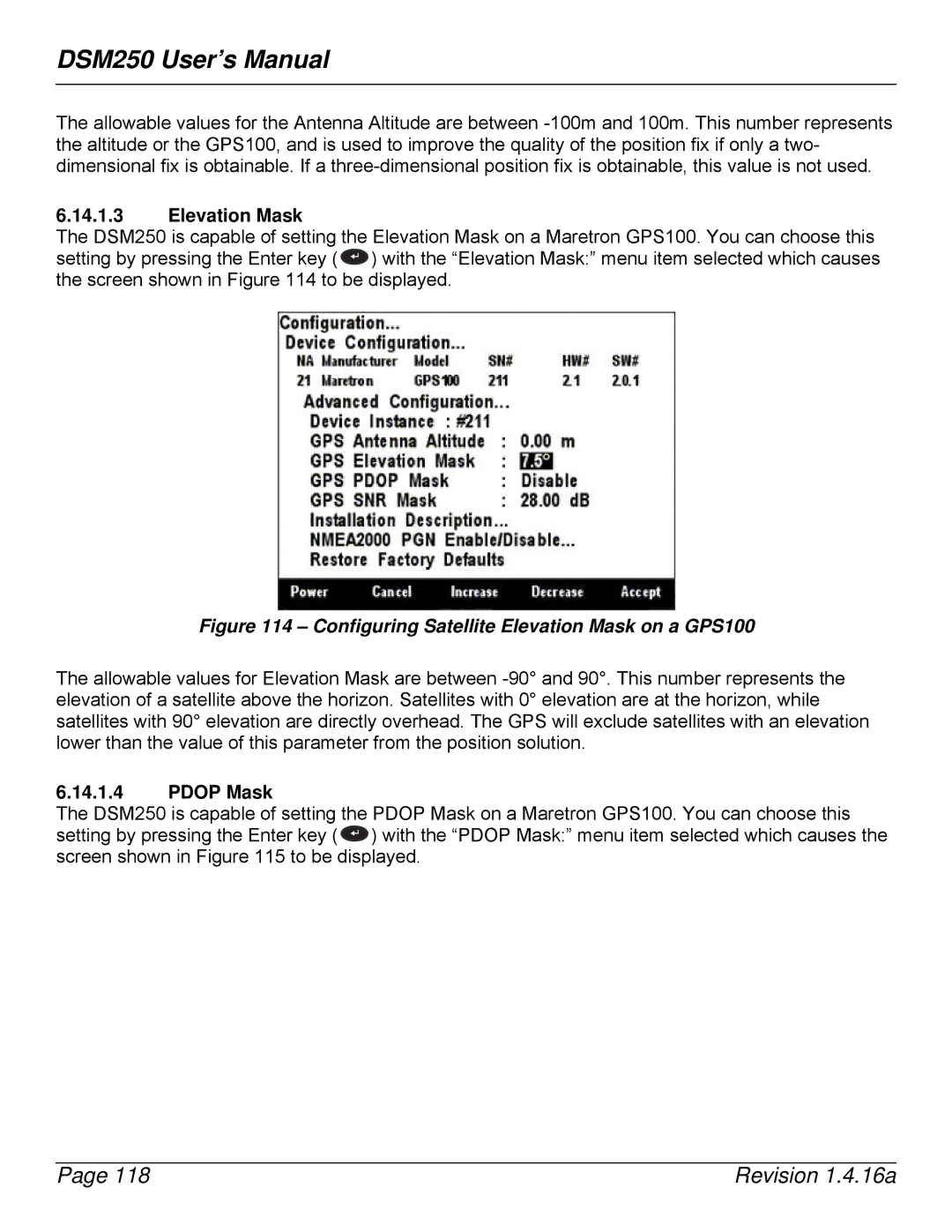
The DSM250 is capable of setting the Elevation Mask on a Maretron GPS100. You can choose this setting by pressing the Enter key ( ![]() ) with the “Elevation Mask:” menu item selected which causes the screen shown in Figure 114 to be displayed.
) with the “Elevation Mask:” menu item selected which causes the screen shown in Figure 114 to be displayed.
Figure 114 – Configuring Satellite Elevation Mask on a GPS100
The allowable values for Elevation Mask are between
6.14.1.4PDOP Mask
The DSM250 is capable of setting the PDOP Mask on a Maretron GPS100. You can choose this setting by pressing the Enter key ( ![]() ) with the “PDOP Mask:” menu item selected which causes the screen shown in Figure 115 to be displayed.
) with the “PDOP Mask:” menu item selected which causes the screen shown in Figure 115 to be displayed.
Page 118 | Revision 1.4.16a |
